
What is recorded here
From the National Monuments Service (Archaeological Survey of Ireland) record LE033-060
Places near here
Photo credits
- Maker not stated on source page, commons.wikimedia.org
- Maker not stated on source page, govisity.com
- Maker not stated on source page, www.flickr.com
- Maker not stated on source page, www.tripadvisor.ca
- Maker not stated on source page, en.wikipedia.org
- Maker not stated on source page, www.tripadvisor.ie
- Willie Donnellan / Leitrim Observer, www.leitrimobserver.ie
- Maker not stated on source page, www.alamy.com
- National Inventory of Architectural Heritage
- Maker named on the Wikimedia Commons picture page · CC BY-SA 2.5
 Mapped cemeteryCemetery · 1162 yd
Explorer Tom At night, this Mapped cemetery in County Leitrim makes a sound like old knees cracking when it gets really cold out…
 Portal tomb in AghavasPortal tomb · 1245 yd
Explorer Tom Portal tomb in Aghavas would spend its lottery win on a very large hat. It’s got two big portal stones acting like…
 Fairy fort / earthen ringfort in CorranearyFairy fort / earthen ringfort · 1427 yd
Explorer Tom Fairy fort / earthen ringfort in Corraneary would tell a teen the 1800s were basically just bad Wi-Fi and mud. It’s…
 Páirc Achadh an Mheasa, Aughavas GAAGAA ground · 1577 yd
 Stone row in Miltron GlebeStone row · 1.1 mi
Explorer Tom Stone row in Miltron Glebe loves singing along to the wind because it thinks the breeze is its personal DJ and the…
 Bullaun stone in Beagh MoreBullaun stone · 1.6 mi
Explorer Tom This Beagh More bullaun holds the world record for looking most confused while sitting by a stream. It’s been there…
 CastleCastle, unclassified · 2.0 mi
Explorer Tom Castle in Agharann went to the road, allegedly, which is a hell of a commute for stone. A stubborn bird won’t leave the…
 Carrigallen GAAGAA ground · 2.6 mi
 Cloone GraveyardCemetery · 3.5 mi
Explorer Tom Cloone Graveyard has had so many names over the years it’s legally required to change them again. It’s like a cat that…
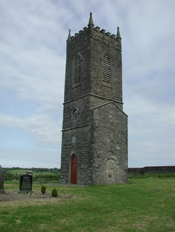 Saint James's Church (Cloone)Church/chapel · 3.5 mi
Explorer Tom Saint James's Church in Cloone had a matchmaker who worked there and paired off half the village. The tower remains…
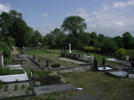 graveyard/cemetery3.5 mi
Explorer Tom Graveyard or cemetery in Cloone was built on a bargain where the locals traded silence for ironwork that is actually…
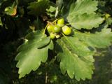 Sessile Oak4.0 mi
Explorer Tom Sessile Oak in County Leitrim remembers when a local priest lost a bet right under its branches. He owed a pint and…
More archaeology and monuments in County Leitrim · All of County Leitrim

What do you know about this place?Tap to add a comment or ask a question