What is recorded here
Half a million years of rain, hoof and plough have not erased the ring at Corraneary. It still holds its shape beside the turning stream, a shallow breath of earth and shadow between the drumlins. People may have lived there, fled there or simply refused to build elsewhere. The fairies, according to local story, took the rest.
Situated in a low-lying position between drumlins on the NW bank of a small NE-SW stream at ta point where it turns S. It is depicted as an enclosure only on the 1909 edition of the OS 6-inch map. This is a grass-covered circular area (int. diam. 21.4m N-S; 19.5m E-W) defined by the remains of a fosse (at S: Wth of base 1.2m; int. D 0.3m; ext. D 0.4m), an outer bank (at S: Wth 9.5m; ext. H 0.7m) surviving S-N, and slight indications of a second, outer fosse W-N. The outer bank and outer fosse are truncated by a field bank at NE and the stream at SE (max. surviving ext. dims 44m N-S; 38m E-W). An original entrance is not identified.
The above description is derived from 'The Archaeological Inventory of County Leitrim' compiled by Michael J. Moore (Dublin: Stationery Office, 2003). In certain instances the entries have been revised and updated in the light of recent research.
Date of upload: 23 September 2008
Amended: 12 September 2019
The monument record does not grant public access. Check the route and ask the landowner before entering private land.
- What survives
- Recorded monument
Places near here
 Holy well in KillyfeaHoly well · 1.8 mi
 Fairy fort / earthen ringfort in AgharannFairy fort / earthen ringfort · 1.9 mi
 Church in Cloone (mohill By.)Church · 2.7 mi
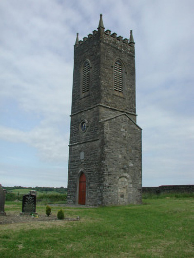 Saint James's Church (Cloone)church/chapel · 2.7 mi
 European YewEuropean Yew · 3.2 mi
 Sessile OakSessile Oak · 3.3 mi
 North Midland Transport CollectionMuseum · 3.4 mi
 King's GraveArchaeological place · 3.6 mi
 CornaferstMountain / peak · 3.8 mi
 DrumbreanlisMountain / peak · 3.8 mi
 Giant's GraveArchaeological place · 5.7 mi
 Little IslandIslet · 6.4 mi