What is recorded here
The following account of this monument is derived from de Valera and Ó Nualláin (1982, 77). ‘This site is shown on the original edition of the OS 6” map as a circular ringfort [LI022-030001-], with stones, named “Cromlech”, in the bank at the north-eastern side. On the 1897 and current edition of the 6” map a crescent of the bank appears with stones shown in the southern part marked ‘Cromlech’. Three stones are present here. One is a pillar standing 1.65m high and the others are small boulders each about 30cms. high. O’Kelly does not accept the bank as the remains of a ringfort but the evidence of the earlier maps together with the place-name “Badgerfort” strongly suggest that it was. However, neither the stones now present or the marking of stones in the north-eastern part of the bank on the original O.S. 6” map are sufficient to warrant acceptance of a megalithic tomb at this site.’
Site described by O'Kelly (1942-3, 243) as following; 'It is not possible to say with absolute certainty that this was not a dolmen, but it is most likely that it was not. It now consists of one large standing stone near which are two low boulders. The standing stone is of limestone and the boulders are a volcanic breccia. The boulders are not quite a foot high, while the standing stone is 5' 6" [1.7m], the base measuring 2' [0.6m] by 1' 3" [0.4m]. The two boulders are probably glacial erratics and the standing stone seems a genuine ancient monument. Neither is there a fort [LI022-030001-] at this site. The whole locality lies on a gravel drift, the surface of which shows many undulations. There is one such undulation just at one side of the standing stone in question. This is crescent shaped and may have been taken to be part of the bank of a fort'. Westropp (1904-5, 372) recorded that there was 'a defaced dolmen in the earth-fort [LI022-030001-] of Badgersrath, east from the church [LI022-018001-]'.
The following account of this monument is derived from de Valera and Ó Nualláin (1982, 77). ‘This site is shown on the original edition of the OS 6” map as a circular ringfort [LI022-030001-], with stones, named “Cromlech”, in the bank at the north-eastern side. On the 1897 and current edition of the 6” map a crescent of the bank appears with stones shown in the southern part marked ‘Cromlech’. Three stones are…
From the National Monuments Service (Archaeological Survey of Ireland) record LI022-030
The monument record does not grant public access. Check the route and ask the landowner before entering private land.
- What survives
- Recorded monument
Places near here
Photo credits
- National Inventory of Architectural Heritage
- Willow, Wikimedia Commons · CC BY 2.5
- JohnArmagh, Wikimedia Commons · Public domain
- Mike Searle, Wikimedia Commons · CC BY-SA 2.0
- Ballyhoura Failte, Wikimedia Commons · CC BY-SA 2.0
- Garry Dickinson, Geograph · CC BY-SA 2.0
Partially hachuredEnclosure · 38 ydVilliers WellSpring · 1017 yd post box1309 ydKilpeacon HouseGate lodge · 1685 ydKilpeacon HouseCountry house · 1.0 miCarnane RockNamed rock · 1.3 miEuropean ash3.1 miMonasteranenagh AbbeyHeritage attraction · 4.3 miFanningstown Castle (in ruins)Castle, tower house · 5.1 miEuropean ash5.5 miGiants GraveMegalithic tomb · 6.0 miCastleCastle, motte and bailey · 9.1 mi
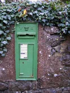 post box1309 yd
 Kilpeacon HouseGate lodge · 1685 yd
 Kilpeacon HouseCountry house · 1.0 miCarnane RockNamed rock · 1.3 mi
 European ash3.1 mi
 Monasteranenagh AbbeyHeritage attraction · 4.3 mi
_-_geograph.org.uk_-_6276354.jpg/250px-Castles_of_Munster,_Fanningstown,_Limerick_(1)_-_geograph.org.uk_-_6276354.jpg "Photo: Mike Searle, Wikimedia Commons · CC BY-SA 2.0") Fanningstown Castle (in ruins)Castle, tower house · 5.1 miEuropean ash5.5 mi
Fanningstown Castle (in ruins)Castle, tower house · 5.1 miEuropean ash5.5 mi Giants GraveMegalithic tomb · 6.0 mi
 CastleCastle, motte and bailey · 9.1 mi
More archaeology and monuments in County Limerick · All of County Limerick
What do you know about this place?