Places near here
Photo credits
- N Chadwick, Geograph · CC BY-SA 2.0
- National Inventory of Architectural Heritage
- John Lucas, Geograph · CC BY-SA 2.0
- Night of the Big Wind, Wikimedia Commons · CC BY-SA 3.0 nl
- Turkishbob at English Wikipedia, Wikimedia Commons · CC BY 2.5
- Public picture contributor, Wikimedia Commons · CC BY-SA 3.0
- Jed Revans, Wikimedia Commons · CC BY-SA 4.0
- dougf, Wikimedia Commons · CC BY-SA 2.0
- N Chadwick, Wikimedia Commons · CC BY-SA 2.0
 Wild Atlantic Way:Visitor information · 41 yd
 Golden StrandBeach / strand · 349 yd
 post box1427 yd
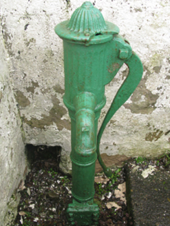 water pump1457 yd
Explorer Tom Water pump in Tonatanvally makes a weird clicking sound at night that scares the locals. They pretend it’s just wind, but they’re lying through their teeth. Sit on a wall near it and pretend you aren't scared.
 Doogort BeachBeach / strand · 1.2 mi
 IndicatedCrannog · 2.5 mi
Explorer Tom Crannog in Dookinelly is the shortcut that isn’t a shortcut because it involves wading through mud and regret. It’s an overgrown island that thinks it’s still fashionable. Visit, then text me what you think. I'll pretend to read it.
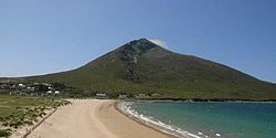 SlievemoreMountain / peak · 2.6 mi
 The Deserted Village at SlievemoreVisitor information · 3.5 mi
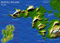 Deserted VillageHeritage attraction · 3.8 mi
 Inis BigilIsland · 3.9 mi
Explorer Tom Inis Bigil sits between Achill and the Mayo mainland, close enough for me to promise an easy crossing and wise enough to demand a boat anyway. The island is about 2.5 by 1.5 kilometres. Its history mixes a Gaeltacht setting with a Protestant community, a real local detail that deserves more than a lazy label. Farming, fishing and winkle picking have all helped people live here. For years there was talk of a cable car across the strong Bullsmouth current; the plan was abandoned, so my offer to swing over on a rope remains equally useless. Arrange a permitted boat from the present departure points, confirm the return and respect homes and working fields. The water is short on a map but powerful in practice. Let the islanders, not my bravado, set the pace.
 Fahy or Doona Castle in ruinsCastle, tower house · 4.4 mi
Explorer Tom Fahy or Doona Castle in ruins is hosting a fiddler who never left his post. He’s been playing since the last ice age and hasn't stopped once. Stand back, squint, and it looks like a castle.
 Achill HengeInstallation · 4.8 mi
Explorer Tom Achill-henge looks ancient from the wrong angle, which is exactly why I should tell you the date before inventing a druid. Joe McNamara built the concrete circle over one weekend in November 2011. Thirty uprights carry a ring more than four metres high, making a shape about a hundred metres around. I have failed to put up a garden fence in two weekends, so the speed alone deserves a raised eyebrow. The nickname borrows the word henge, but this is modern construction, not a prehistoric monument. That difference makes the place more curious, not less: an island landscape suddenly gained a giant question mark in concrete. Access across the surrounding land needs to follow current permission and safe paths; do not assume the structure is a public climbing frame. View it with the mountains behind, then ask what I would have built with a free weekend. Nothing this straight, I promise.
More viewpoints and information in County Mayo · All of County Mayo

What do you know about this place?Tap to add a comment or ask a question