What is recorded here
In small clearing in forestry atop Monteen Hill. Circular earthen mound (H 1.55m; diam. 10.9m) enclosed on top (diam. c. 5m) by low earthen bank E->N giving appearance of depression in centre. Investigated by Windele in 1842 (O'Mahoney 1909, 215-217) who describes hollow on top (2.5 feet deep and 11 feet diameter) and 'broken range of 25 stones' (diam. 35 feet) barely protruding above ground level around base. Tunnel was dug from E side and abandoned when 'no kist or remains of any kind' were found.
In small clearing in forestry atop Monteen Hill. Circular earthen mound (H 1.55m; diam. 10.9m) enclosed on top (diam. c. 5m) by low earthen bank E->N giving appearance of depression in centre. Investigated by Windele in 1842 (O'Mahoney 1909, 215-217) who describes hollow on top (2.5 feet deep and 11 feet diameter) and 'broken range of 25 stones' (diam. 35 feet) barely protruding above ground level around base.…
From the National Monuments Service (Archaeological Survey of Ireland) record CO123-004
The monument record does not grant public access. Check the route and ask the landowner before entering private land.
- What survives
- Recorded monument
Places near here
Photo credits
- National Inventory of Architectural Heritage
- Maker named on the Wikimedia Commons picture page · Public domain
- Mike Searle, Wikimedia Commons · CC BY-SA 2.0
Monteen Castle (in Ruins)Castle, tower house · 726 yd ArdnavahaRectory/glebe/vicarage/curate's house · 902 ydEnglish holly929 ydSkeaf BridgeBridge · 952 ydGraveyard in KilmalodaGraveyard · 965 ydMan-made underground passage in Farran (carbery East (e.d.) By.)Man-made underground passage · 1.0 miCaveMan-made underground passage · 1.1 miBallinoroher CastleCastle · 2.1 miArgideen Loop WalksVisitor information · 2.1 miArgideen Valley trailVisitor information · 2.1 miJohnny Sheila MurphyMemorial · 2.2 miGarden WoodWood · 2.5 mi
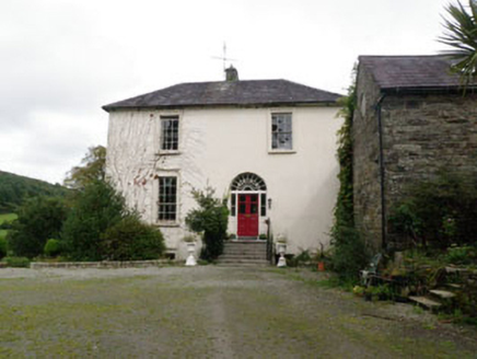 ArdnavahaRectory/glebe/vicarage/curate's house · 902 yd
 English holly929 yd
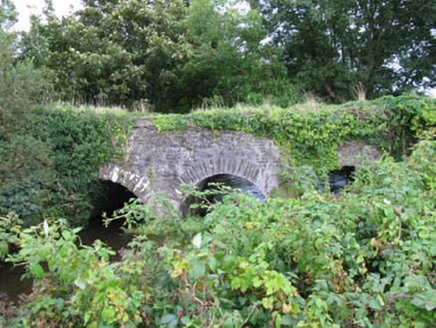 Skeaf BridgeBridge · 952 ydGraveyard in KilmalodaGraveyard · 965 ydMan-made underground passage in Farran (carbery East (e.d.) By.)Man-made underground passage · 1.0 miCaveMan-made underground passage · 1.1 mi
 Ballinoroher CastleCastle · 2.1 miArgideen Loop WalksVisitor information · 2.1 miArgideen Valley trailVisitor information · 2.1 miJohnny Sheila MurphyMemorial · 2.2 miGarden WoodWood · 2.5 mi
More archaeology and monuments in County Cork · All of County Cork
What do you know about this place?