
What is recorded here
From the National Monuments Service (Archaeological Survey of Ireland) record CO115-044
Places near here
Photo credits
- National Inventory of Architectural Heritage
- Towel401, Wikimedia Commons · CC BY-SA 4.0
- Colin Park, Geograph · CC BY-SA 2.0
- Ericpol ( talk ), Wikimedia Commons · CC BY-SA 3.0
- Gordon Hatton, Geograph · CC BY-SA 2.0
- Jeff Buck, Geograph · CC BY-SA 2.0
- Adriaen van Diest, Wikimedia Commons · Public domain
- El Gringo ( talk ) ( Uploads ), Wikimedia Commons · CC BY 2.5
- Mike Searle, Wikimedia Commons · CC BY-SA 2.0
- Nomasoft, Wikimedia Commons · CC BY-SA 4.0
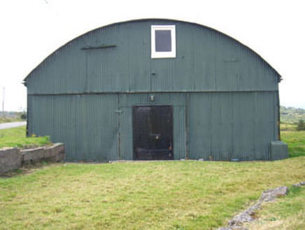 sports hall/centre/gymnasium56 yd
Explorer Tom Sports hall in Rerrin is just corrugated iron pretending to be a gym, built back when cheap was king. It’s rare now, so don’t let it rust away without a selfie.
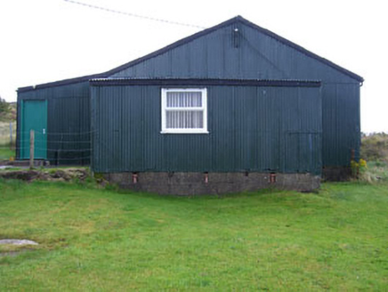 church/chapel230 yd
Explorer Tom Church or chapel in Rerrin is made of corrugated iron, which feels a bit like camping gear for God. The whole parish probably argued about whether it was trendy or cheap. I say it’s got character, even if it rusts.
 Bere IslandIsland · 1.8 mi
 KnockanalligMountain / peak · 2.7 mi
 Hungry HillMountain / peak · 3.5 mi
 Dinish IslandIslet · 3.9 mi
 Mare's Tail WaterfallViewpoint · 4.1 mi
 Battle of Bantry BayMajor battlefield · 4.2 mi
Explorer Tom Battle of Bantry Bay in County Cork is where a French admiral got his arse kicked by the weather before he even saw an English ship. Ideal for a moody photo you'll pretend wasn't posed.
 Peakeen Ridge Loop WalkWalking route · 4.8 mi
 Siege of DunboySiege · 4.8 mi
Explorer Tom Siege of Dunboy is basically a county fair entry that never won anything but stubbornness. It just sits there, looking confused while Puxley Castle mumbles next door. A handy spot to stretch your legs and your imagination.
 Castle (in Ruins)Castle, tower house · 4.8 mi
Explorer Tom Castle at Dunboy is playing hard to get on that rocky bit by Bear Island. The O'Sullivans built it, but now it's just ground floor and a mystery. Bring your own legend, I've run out.
 Dunboy CastleCastle · 4.8 mi
Explorer Tom Dunboy Castle in County Cork has a tree growing right through it, which is nature saying 'move along, you are taking up space.' I bet the roots are digging for treasure or lost keys. Look under that bark!
More archaeology and monuments in County Cork · All of County Cork

What do you know about this place?Tap to add a comment or ask a question