What is recorded here
From OpenStreetMap (© OpenStreetMap contributors) w295616804
Places near here
Photo credits
- Maker not stated on source page, www.britannica.com
- Maker not stated on source page, www.pinterest.com
- Maker not stated on source page, paganplaces.com
- Sitomon, Wikimedia Commons · CC BY-SA 2.0
- Maker not stated on source page, www.tripadvisor.com.ph
- Golfing in Ireland; photographer not stated, Source publisher
- Maker not stated on source page, www.alamy.com
- Matthew Chadwick, Wikimedia Commons · CC BY-SA 2.0
- August Schwerdfeger, Wikimedia Commons · CC BY 4.0
- Patrick Brown, Wikimedia Commons · CC BY-SA 2.0
- Neil Forrester, Co.Meath, Ireland. http://neil.forrester.ie, Wikimedia Commons · CC BY 3.0
 Church (in Ruins)Church · 701 yd
Explorer Tom Church in Dowdstown has changed its name so many times I’ve lost count, which is a new personal record for me. It’s…
 CastleHouse, 16th/17th century · 1560 yd
Explorer Tom Castle in Castletown Tara thinks the local sheep are its biggest fans, but they mostly just use the stream nearby to…
 Linear earthwork in Castletown TaraLinear earthwork · 1593 yd
Explorer Tom Linear earthwork in Castletown Tara would write 'seeking long-term relationship' on its dating profile, but nobody…
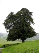 European Yew1606 yd
Explorer Tom European Yew in County Meath once saw a farmer drop his lunch and swear for twenty minutes straight. It’s ancient…
 St. Bridget's WellSpring · 1608 yd
Explorer Tom St. Bridget's Well was designed by a mother-in-law who wanted every visitor to feel judged, so it stands there looking…
St. Bridgets WellStone head · 1611 ydExplorer Tom St. Bridgets Well features a female head staring down from the arch, keeping secrets for centuries. She looks like she…
 Royal Tara Golf ClubGolf course · 1645 yd
 Stone sculpture (present location) in Castleboy (skreen By., Tara Par.)Stone sculpture (present location) · 1.8 mi
Explorer Tom Stone sculpture in Castleboy has moved house more times than I have since leaving home. It’s a tomb panel from 1571…
 Hill of TaraMountain / peak · 1.8 mi
Explorer Tom Come looking for a king's chair? Bring imagination, not a throne. The Hill of Tara is not one neat royal throne with a…
 Lia Fáil: Hill of TaraLegend location · 1.9 mi
Explorer Tom Lia Fáil: Hill of Tara is a stone with high standards. Legend says it shouted for the rightful king, which would make…
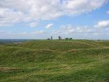 Battle of Tara (Ireland)Major battlefield · 2.0 mi
Explorer Tom Battle of Tara (Ireland) in County Meath has had more names than I have socks in my drawer right now. Kings fought…
 Battle of Tara HillBattle · 2.0 mi
Explorer Tom Battle of Tara Hill is still trying to remember if it was a fight or just a very aggressive family gathering. A fiddler…
More memorials and graveyards in County Meath · All of County Meath

What do you know about this place?Tap to add a comment or ask a question