What is recorded here
From OpenStreetMap (© OpenStreetMap contributors) w208127120
Places near here
Photo credits
- National Inventory of Architectural Heritage
- Mike Searle, Geograph · CC BY-SA 2.0
- N Chadwick, Geograph · CC BY-SA 2.0
- Maker not stated on source page, commons.wikimedia.org
- Get Lost Mountaineering; photographer not stated, Get Lost Mountaineering
- Maker not stated on source page, www.dreamstime.com
- Maker not stated on source page, www.wikidata.org
 Saint Patrick's Catholic ChurchChurch/chapel · 13 yd
Explorer Tom Saint Patrick's Catholic Church in Anglesborough is refusing to crumble because it thinks gravity is just a rumour.…
 bridge147 yd
Explorer Tom Bridge in Anglesborough is showing off its secret talent: it’s an absolute champion at pretending to be a tunnel. It’s…
 Massy LodgeCountry house · 924 yd
Explorer Tom Massy Lodge was built for summer escapes, so it’s probably still napping in the sun like a lazy cat. Charles Frederick…
 Paradise HillMountain / peak · 1272 yd
Explorer Tom Paradise Hill in County Limerick is absolutely sick of people asking if it’s actually paradise, because let’s face it…
 Ballymahony BridgeBridge · 1403 yd
Explorer Tom Ballymahony Bridge in Limerick is so solidly built that the map makers got confused and drew it twice just to be sure…
 Earthwork in Ballyfauskeen (coshlea By., Anglesborough Ed)Earthwork · 1.3 mi
Explorer Tom Earthwork in Ballyfauskeen ended up here because its GPS broke on a rainy Tuesday. It’s rectangular and looks like it’s…
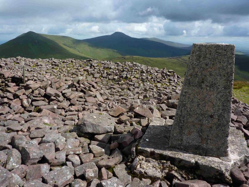 Temple HillMountain / peak · 1.9 mi
Explorer Tom Temple Hill sounds as if the Galtees have hidden a grand stone shrine on top and are waiting for Tom to announce…
 Assaroola BridgeBridge · 2.0 mi
Explorer Tom Assaroola Bridge is letting the local sheep have their say about its tiny arch. The animals think it’s too small for…
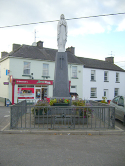 monument3.4 mi
Explorer Tom Monument in Ballylanders stands at a crossroads, carving its name into the stone of history with the subtlety of a…
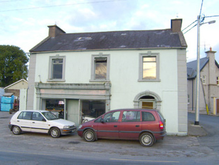 WalshHouse · 3.4 mi
Explorer Tom House Walsh in Ballylanders holds a fake world record for most ornate render details per square foot. It stands out…
 Church in KilgarriffChurch · 3.7 mi
Explorer Tom Church in Kilgarriff got completely lost on the map because the cartographer was having a bad day and a worse cup of…
 Fairy fort / earthen ringfort in BallyfeerodeFairy fort / earthen ringfort · 3.7 mi
Explorer Tom Fairy fort / earthen ringfort in Ballyfeerode is arguing with the river over parking rights. It’s got a diamond-shaped…
More memorials and graveyards in County Limerick · All of County Limerick

What do you know about this place?Tap to add a comment or ask a question