What is recorded here
From OpenStreetMap (© OpenStreetMap contributors) w1314046734
Places near here
Photo credits
- Maker not stated on source page, www.flickr.com
- Aubrey Dale, Wikimedia Commons · CC BY-SA 2.0
- Maker not stated on source page, www.tripadvisor.ca
- Maker not stated on source page, ru.wikipedia.org
- Maker not stated on source page, www.dreamstime.com
- Maker not stated on source page, in.pinterest.com
- Maker not stated on source page, www.pinterest.com
- Albert Bridge, Wikimedia Commons · CC BY-SA 2.0
- Mund000, Wikimedia Commons · CC BY-SA 4.0
- Eric Jones, Wikimedia Commons · CC BY-SA 2.0
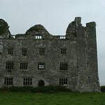 Fortification: magennis castle in DrumnahareFortification: Magennis Castle · 655 yd
Explorer Tom Fortification: Magennis Castle in Drumnahare would tell its younger self to stop trying so hard to look tough. It’s…
 Loughbrickland CrannógArchaeological place · 690 yd
Explorer Tom Loughbrickland Crannóg is a tiny island house that made a New Year's resolution to stop sinking, but it’s still…
 Standing stone in DrumnahareStanding Stone · 785 yd
Explorer Tom Standing stone in Drumnahare has been standing there since before anyone remembered how to count properly. Its first…
 Enclosure? in DerrydrummuckEnclosure? · 1011 yd
Explorer Tom Enclosure? in Derrydrummuck isn't even sure it's real yet, which is why it has a question mark. It would get 'I was…
 Enclosure in DrumnahareEnclosure · 1334 yd
Explorer Tom Enclosure in Drumnahare claims to hold a world record for being the most ignored spot in County Down. It’s very bitter…
 Enclosure in CaskumEnclosure · 1356 yd
Explorer Tom Enclosure in Caskum keeps getting picked on by the wind because it has the audacity to stand there looking so perfectly…
 Neolithic Settlement, Rectangular Houses, Stone Row, Bronze Age Barrow Cemetery in BallintaggartNeolithic Settlement, Rectangular Houses, Stone Row, Bronze Age Barrow Cemetery · 1506 yd
Explorer Tom Ballintaggart has a Neolithic settlement with rectangular houses and a barrow cemetery, which is basically a very…
 Coolnacran RingfortArchaeological place · 1.3 mi
Explorer Tom Coolnacran Ringfort in County Down has a secret talent that nobody talks about: it’s an excellent trampoline if you’ve…
Enclosure in LisnagonnellEnclosure · 1.4 miExplorer Tom Enclosure in Lisnagonnell started from a bet two lads made in the pub about who could dig the biggest hole before…
 Poland's BridgeBridge · 4.5 mi
Explorer Tom Poland's Bridge is an 1840s railway relic that probably writes a very dramatic dating profile. It claims to be…
 KnockiveaghMountain / peak · 4.6 mi
Explorer Tom Knockiveagh in County Down was once used for smuggling illegal sheep wool across the border by guys in really bad wigs.…
 Former Quaker Meeting HouseHall · 6.8 mi
Explorer Tom Former Quaker Meeting House in Kiltarriff has a bird on the roof who refuses to leave and is currently winning the…
More memorials and graveyards in County Down · All of County Down

What do you know about this place?Tap to add a comment or ask a question