
What is recorded here
From the National Monuments Service (Archaeological Survey of Ireland) record CO042-062002
Places near here
Photo credits
- Maker not stated on source page, www.dreamstime.com
- Maker not stated on source page, commons.wikimedia.org
- Maker not stated on source page, www.pinterest.com
- Maker not stated on source page, worldlist.vision
- Frederick Dean, Geograph · CC BY-SA 2.0
- Maker not stated on source page, en.tripadvisor.com.hk
- Chani Anderson / EchoLive, www.echolive.ie
- National Inventory of Architectural Heritage
- Golfing in Ireland; photographer not stated, Source publisher
- Maker not stated on source page, www.nationalgeographic.com
 Fairy fort / earthen ringfort in KnutteryFairy fort / earthen ringfort · 18 yd
Explorer Tom Fairy fort / earthen ringfort in Knuttery has a hidden treasure that is definitely a biscuit tin, not gold. Three big…
 Fairy fort / earthen ringfort in Knockbrack (fermoy By., Rahan Par.)Fairy fort / earthen ringfort · 276 yd
Explorer Tom Fairy fort / earthen ringfort in Knockbrack has an underground passage inside it, which is either brilliant or…
 Standing stone in Island (fermoy By.)Standing stone · 1.1 mi
Explorer Tom Another standing stone in Island is 3m high and leaning heavily to the south-east. It’s rectangular on a slope. Looks…
 Anomalous stone group in Island (fermoy By.)Anomalous stone group · 1.3 mi
Explorer Tom "Anomalous stone group in Island is four stones arranged like a trapezium that have since flatlined into the field.…
 Island Wedge TombArchaeological place · 1.5 mi
Explorer Tom Island Wedge Tomb in County Cork once had a cow try to buy it with a bunch of shiny stones. The cow lost, naturally…
 Stone CircleWedge tomb · 1.5 mi
Explorer Tom Stone Circle on the Island is actually a wedge tomb that got dressed up in a U-shaped wall. It sits on a knoll near…
 Wedge tomb in Island (fermoy By.)Wedge tomb · 1.5 mi
Explorer Tom Wedge tomb in Island was taken down around 1877 because the stones were brittle and burnt. There’s no visible surface…
 Clyda Rovers GAA pitchGAA ground · 3.4 mi
 Coom BridgeBridge · 3.9 mi
Explorer Tom Coom Bridge has two low stone arches that are just chilling over the Bride River since 1800. The stonemasons really…
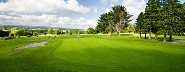 Mallow Golf ClubGolf course · 4.7 mi
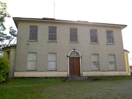 Carrokeal HouseHouse · 5.0 mi
Explorer Tom Carrokeal House in Carhookeal is a big, symmetrical mansion from around eighteen-ten that looks down on the new housing…
 Power’s BridgeWaterfall · 5.1 mi
Explorer Tom Power’s Bridge swears by a superstition that says if you trip on it, your luck is officially reversed until next…
More archaeology and monuments in County Cork · All of County Cork

What do you know about this place?Tap to add a comment or ask a question