What is recorded here
Dungooly is a place where the ground itself becomes a room. Inside the old ringfort, an L-shaped depression marks the collapse of a man-made underground passage. The ceiling fell, but the shape remained. A person may have dug that space to hide, meditate or simply avoid the weather. The earth kept the answer while forgetting the name.
The following description is derived from both the published 'Archaeological Inventory of County Louth' (Dublin: Stationery Office, 1986) and the 'Archaeological Survey of County Louth' (Dublin: Stationery Office, 1991). In certain instances the entries have been revised and updated in the light of recent research.
Date of upload/revision: 17 July 2007
Situated in the interior of ringfort (LH003-001001-), is an L-shaped depression which may be a collapsed Man-made underground passage.
The monument record does not grant public access. Check the route and ask the landowner before entering private land.
- What survives
- Recorded monument
Places near here
 ENCLOSURE in CarriveENCLOSURE · 437 yd
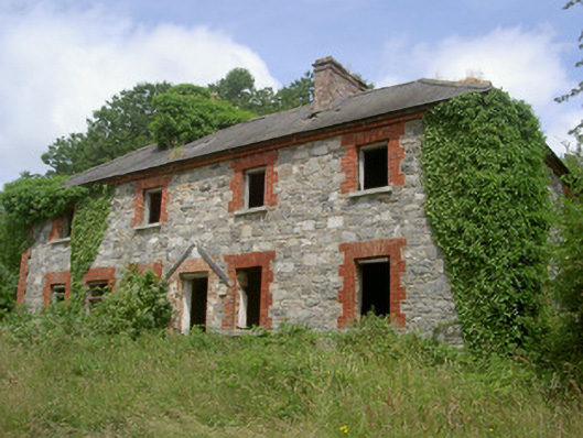 Dungooly Millmiller's house · 1192 yd
 Bawn in DungoolyBawn · 1194 yd
 Holy well in DrumbillaHoly well · 1292 yd
 CroslieveMountain / peak · 1434 yd
 Dungooly Bridgebridge · 1483 yd
 Mass Rock Loop TrailWalking route · 1705 yd
 Forkhill Greenspace PathwayWalking route · 1.1 mi
 Ballsmill Amenity LandPicnic place · 1.1 mi
 Ring of Gullion Way - ForkhillVisitor information · 1.3 mi
 Sky HillMountain / peak · 1.4 mi
 Golf 30Fort · 1.9 mi