What is recorded here
According to local information, stone flags uncovered in SW quadrant of ringfort (CO107-01001-) may have formed roof of chamber.
From the National Monuments Service (Archaeological Survey of Ireland) record CO107-010002
The monument record does not grant public access. Check the route and ask the landowner before entering private land.
- What survives
- Recorded monument
Places near here
Photo credits
- National Inventory of Architectural Heritage
- Richard Fensome, Geograph · Creative Commons Attribution-ShareAlike 2.0
- Mike Searle, Wikimedia Commons · CC BY-SA 2.0
- Jane Carver, Wikimedia Commons · CC BY-SA 2.0
- Neville Goodman, Geograph · CC BY-SA 2.0
- Graham Horn, Geograph · CC BY-SA 2.0
- Hywel Williams, Geograph · CC BY-SA 2.0
- Mike Searle, Geograph · CC BY-SA 2.0
- Graham Horn, Geograph · Creative Commons Attribution-ShareAlike 2.0
- mozzercork @ flickr, Wikimedia Commons · CC BY 2.0
- Willow, Wikimedia Commons · CC BY 2.5
 school655 yd
 St. Edmund's Church of Ireland ChurchChurch/chapel · 776 yd
 Togher CastleCastle, tower house · 1.8 mi
 Nowen HillMountain / peak · 2.7 mi
 Milane HillMountain / peak · 3.1 miFunmanway Adventure LandHeritage attraction · 3.1 mi
 Castle Donovan (in Ruins)Castle, tower house · 5.2 mi
 GallaunsStone circle, five-stone · 7.8 mi
 Kealkill stone circleVisitor information · 7.9 mi
 Caheragh Burial GroundGraveyard · 8.7 mi
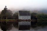 Gougane BarraValley and heritage place · 8.8 mi
 European ash8.9 mi
More archaeology and monuments in County Cork · All of County Cork
What do you know about this place?