
What is recorded here
On S side of Blackwater River, c. 1.5 km SW of Mallow; c. 500m N of New Mill (15227). Only fragmentary remains of S wall of mill now stand. Millrace survives with flowing water, indicated on 1842 OS 6-inch maps flowing into wheel-pit alongside E end of building. Cut-stone wheel-pit contained turbine, recently removed for repairs, which powers generator housed in modern building erected over wheel-pit. Mill manager lived in adjacent Millbrook house which is of 19th-century appearance. Two houses (CO033-137----, CO033-138----) are shown here on Down Survey (1655-6) barony map . Identified by Berry (1894, 23) as site of 'Manor Mills' in existence at least from time of James 1 (1603-25). Its ancient water-course was diverted in 1826 to serve New Mill (15227) (ibid., 24). Named on 1842 OS 6-inch map 'Mallow Flour Mills'. Known locally as "old mills". Abandoned in 1930s and subsequently largely demolished.
The above description is derived from the published 'Archaeological Inventory of County Cork. Volume 4: North Cork' (Dublin: Stationery Office, 2000). In certain instances the entries have been revised and updated in the light of recent research.
Date of upload/revision: 14 January 2009
The monument record does not grant public access. Check the route and ask the landowner before entering private land.
- What survives
- Recorded monument
Places near here
 Millbrookmill manager's house · 62 yd
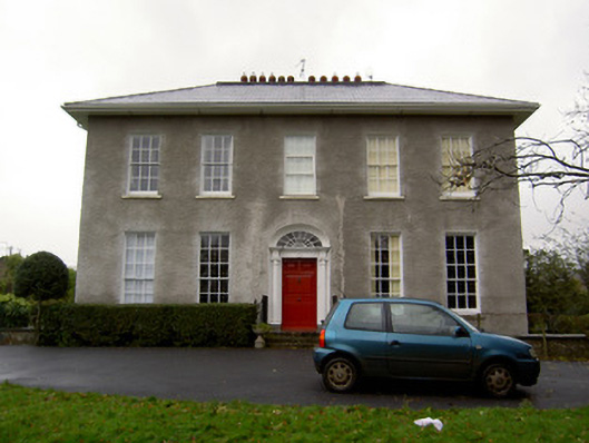 Wiltonhouse · 68 yd
 Mallow River TrailVisitor information · 398 yd
 In loving memory of Elvis O'DonoghueMemorial · 408 yd
 Corn Mill AqueductMilling complex · 601 yd
 Blackwater WayWalking route · 810 yd
 Castle (Site of )Castle, unclassified · 1291 yd
 Site of R C ChapelChurch · 1470 yd
 Mallow Castle (in Ruins)House, fortified house · 1691 yd
 Mallow Town Park - Maple WoodsForest · 1.4 mi
 Lover' LeapCliff · 1.7 mi
 Lover's LeapCliff · 1.7 mi
Other information
Photo: Credit not shown in the picture search · Rights wording not checked; contact us if this picture should be removed