What is recorded here
A humpback road bridge (Wth 8m; long axis N-S) spanning the River Maine. It is built of coursed rubble sandstone and shale with cut limestone detail and has three eliptical arches (spans from N 6.6m, 9.1m, 6.9m) with dressed limestone voussoirs. There are low pointed cutwaters of limestone ashlar on both sides of the piers. An eliptical dry arch (span 2m) occurs on each bank of the river. There is a decorative niche in each abuttment and a recessed circular medallion in each spandrel. The parapets have concrete coping. A plaque on the inner face of the E parapet records the building of the bridge in 1818. This bridge is also known locally as 'Marshall's Bridge'. (Castleisland District Archaeological Survey)
Compiled by: Elizabeth Byrne, Ursula Egan and Sheila Ronan, Archaeological Survey Unit, University College, Cork.
Date of upload: 31 January 2011
The monument record does not grant public access. Check the route and ask the landowner before entering private land.
- What survives
- Recorded monument
Places near here
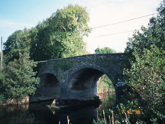 Maine Bridgebridge · 1 yd
 Kealboy Br.Bridge · 1077 yd
 Site of Currans CastleCastle, unclassified · 1230 yd
 LissateomraArchaeological place · 1427 yd
 LispatrickbaunArchaeological place · 1607 yd
 CastleCastle, ringwork · 1.4 mi
 Ballygamboon Forest Recreation AreaWood · 4.4 mi
 Common AlderCommon Alder · 5.0 mi
 PoulatouirtCave · 5.2 mi
 CruslineMountain / peak · 8.1 mi
 Aghadoe Early Medieval Ecclesiastical SiteHeritage attraction · 8.4 mi
 Stack's MountainMountain / peak · 8.4 mi