
What is recorded here
In a small pocket of woodland surrounded by pasture. Named ‘Macduagh’s Holy Well’ on the 1838 and 1922 editions of the OS 6-inch maps, this natural spring well is known locally as ‘Colman’s Well’. It is rectangular in shape (1.56m N-S; 0.94m E-W; D 0.75m) and is lined with drystone walling. A single step (L 0.94m; Wth…
Read the whole record
From the National Monuments Service (Archaeological Survey of Ireland) record GA122-012
Places near here
Photo credits
- Maker not stated on source page, commons.wikimedia.org
- Maker not stated on source page, www.gettyimages.com
- DeeEmm, Geograph · CC BY-SA 2.0
- Maker not stated on source page, uk.pinterest.com
- Maker not stated on source page, en.wikipedia.org
- National Inventory of Architectural Heritage
- Maker not stated on source page, www.visitgalway.ie
- Maker not stated on source page, www.dreamstime.com
- Maker not stated on source page, in.pinterest.com
- Golfing in Ireland; photographer not stated, Source publisher
- John M, Geograph · CC BY-SA 2.0
- Kmcnamee, Wikimedia Commons · CC BY-SA 4.0
 Fairy fort / stone ringfort in Killinny EastFairy fort / stone ringfort · 731 yd
Explorer Tom Fairy fort in Killinny East would post a selfie with the caption 'still here, mostly' if it had a phone signal. It…
 Fairy fort / earthen ringfort in ShigaunaghFairy fort / earthen ringfort · 1206 yd
Explorer Tom Fairy fort / earthen ringfort in Shigaunagh is split down the middle, which is either bad feng shui or just how they do…
 Castle in ruinsCastle, tower house · 1216 yd
Explorer Tom Castle in ruins in Caherglassaun is playing hide-and-seek with me. The local sheep think it's a very fancy rock, but…
 Killinny Church in ruinsChurch · 1343 yd
Explorer Tom Killinny Church in ruins is proud of the fact that it survived a fire by simply pretending not to be there. It’s now…
 Ecclesiastical enclosure in Killinny EastEcclesiastical enclosure · 1365 yd
Explorer Tom Ecclesiastical enclosure in Killinny East suspects the postman of stealing its soul every single morning without…
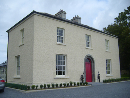 Maryville HouseHouse · 1.8 mi
Explorer Tom Maryville House has a priest who lost a bet there, and he’s still not over it. The limestone doorway is tooled so well…
 Cahererillan Castle (in ruins)Castle, tower house · 1.8 mi
Explorer Tom Cahererillan Castle has a New Year's resolution to stop growing ivy on its face. It's a five-storey tower that looks…
 Mapped cemeteryCemetery · 3.0 mi
Explorer Tom Mapped cemetery in County Galway has one bird that refuses to leave, insisting it’s the official groundskeeper despite…
 Mountcross CemeteryGraveyard · 3.0 mi
Explorer Tom If Mountcross Cemetery in County Galway could talk to its younger self, it would tell it to stop worrying about the…
 Gort Golf ClubGolf course · 3.1 mi
 Kilmacduagh Monastic SiteVisitor information · 3.9 mi
Explorer Tom Kilmacduagh Monastic Site thinks Dublin tourists are basically overgrown children who need a stern lecture about…
 Gort GAAGAA ground · 4.9 mi
More archaeology and monuments in County Galway · All of County Galway

What do you know about this place?Tap to add a comment or ask a question