
What is recorded here
Places near here
Photo credits
- A McCarron, Wikimedia Commons · CC BY-SA 2.0
- Maker not stated on source page, www.pinterest.com
- National Inventory of Architectural Heritage
- Kenneth Allen, Geograph · CC BY-SA 2.0
- Maker not stated on source page, curiousireland.ie
- Anne Burgess, Wikimedia Commons · CC BY-SA 2.0
- Maker not stated on source page, www.flickr.com
- Maker not stated on source page, ca.pinterest.com
- louise price, Geograph · CC BY-SA 2.0
- Maker not stated on source page, ru.pinterest.com
- Kenneth Allen, Wikimedia Commons
 Lough Aghnish Promontory FortPromontory fort, inland · 754 yd
Explorer Tom Lough Aghnish Promontory Fort cuts off a peninsula with a stone wall that has a weird, angled entrance. The base is…
 An Claondoire Burial Cairn above Lough AghnishCairn, burial cairn · 918 yd
Explorer Tom An Claondoire Burial Cairn above Lough Aghnish covered much of a steep hilltop when surveyed. It had several old…
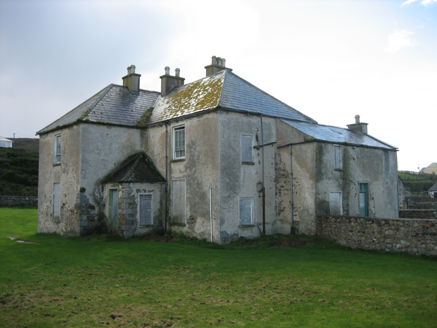 The RectoryRectory/glebe/vicarage/curate's house · 949 yd
Explorer Tom The Rectory in Maghery Glebe was built around 1825 and looks toward Maghery Bay. If I had a desk full of paperwork…
 Strand View BarPub · 992 yd
Explorer Tom Strand View Bar probably has a view of the sea and a lot of people staring at it. It's in Donegal, where the wind tries…
 Portal tomb in An Roisín TheasPortal tomb · 1221 yd
Explorer Tom Portal tomb in An Roisín Theas has lost a few bricks since an artist sketched it back in the 1790s. It’s tucked into a…
 Lop 74Watch tower · 1648 yd
Explorer Tom Lop 74 was a small coast watch hut erected around 1941, with a canted western half and a fireplace. From its elevated…
 CroaghnamaddyMountain / peak · 1.4 mi
Explorer Tom Craigawaddykeagh in County Donegal is showing off its name like a peacock. If it won the lotto, it’d buy a bigger hat…
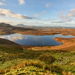 Lough Illion IslandIslet · 1.5 mi
Explorer Tom Lough Illion Island would order the biggest chipper possible at any local shop, specifically requesting extra mayo and…
 Illan UilleIslet · 1.5 mi
Explorer Tom Illan Uille is on the map because someone spelled it wrong in a hurry and nobody wanted to fix it afterwards. The…
 DooeyOfficial bathing water · 3.8 mi
Explorer Tom Dooey Beach gives you three kilometres of Donegal sand and then dares you to say you have run out of room for a walk. I…
 Mapped cemeteryCemetery · 4.4 mi
Explorer Tom Mapped cemetery complains to the council about how the grass is always too short on the left side because it likes…
 Trá an ChaisilBeach / strand · 4.4 mi
Explorer Tom Trá an Chaisil on Arranmore has a cracking trick: it puts a small island shore beside a story that reaches across…
More walking routes in County Donegal · All of County Donegal

What do you know about this place?Tap to add a comment or ask a question