What is recorded here
Map note: Long Plantation appears on the map as a forest near Gorebridge, Midlothian, Scotland. The landscape can keep its secrets; the map gives away the location.
From OpenStreetMap (© OpenStreetMap contributors) w290394919
Places near here
Photo credits
- Richard Webb, Wikimedia Commons · CC BY-SA 2.0
- Maker not stated on source page, www.joinmychurch.com
- Anne Burgess, Wikimedia Commons · CC BY-SA 2.0
- James Denham, Wikimedia Commons · CC BY-SA 2.0
- John Lord, Wikimedia Commons · CC BY-SA 2.0
- Colin Pyle, Wikimedia Commons · CC BY-SA 2.0
- M J Richardson, Wikimedia Commons · CC BY-SA 2.0
- Jim Barton, Wikimedia Commons · CC BY-SA 2.0
- Maker not stated on source page, www.flickr.com
 GorebridgeField Boundary(s), Mine (possible), Track (19th Century) · 777 yd
 Blinkbonny FarmFarmhouse · 915 yd
 Camp WoodWood · 1110 yd
 Gorebridge, Lower Bonnybank Road, United Presbyterian ChurchChurch (19th Century) - (20th Century) · 1154 yd
 Gorebridge, Barleyknowe Lane, Leisure CentreLeisure Centre (modern) · 1167 yd
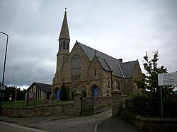 Gorebridge, Hunterfield Road, Gorebridge Parish ChurchChurch (19th Century), War Memorial (20th Century) · 1208 yd
 Gorebridge, Hunterfield Road, Gorebridge Parish Church, Church HallHall (modern) · 1233 yd
 Gorebridge, Hunterfield Road, St Paul's ChurchChurch (19th Century) · 1236 yd
 Masterton WoodWood · 1279 yd
 Newbyres CastleTower House (medieval) · 1400 yd
 Arniston Public ParkPark · 1690 yd
Explorer Tom Arniston Public Park in Gorebridge has a name grand enough for a ceremonial entrance, but its main business is much…
 Southside CastleGrange (medieval), Tower House (medieval) · 1.4 mi
More woods, forests and old trees in Midlothian · All of Midlothian

What do you know about this place?Tap to add a comment or ask a question