DDiscover AloneMapAbout

Loher Fort

Fairy fort / stone ringfort
Computer-made picture that does not show Loher FortNot a photo of this monument
Computer-made picture. It does not show this monument. · Report the wrong picture

The monument record does not grant public access. Check the route and ask the landowner before entering private land.

What do you know about this place?Tap to add a comment or ask a question

What you write will be public.

What is recorded here

National Monument No. 611. Internal diam. 18.4m N-S, 19.8m E-W. Loher Fort/Cathair an Lóthair: This substantial caher is located on the lower W slopes of Farraniaragh mountain, commanding an impressive view over Ballinskelligs Bay to W. Excavations at the site, undertaken by O'Flaherty in the early 1980s, revealed…

Read the whole record
National Monument No. 611. Internal diam. 18.4m N-S, 19.8m E-W. Loher Fort/Cathair an Lóthair: This substantial caher is located on the lower W slopes of Farraniaragh mountain, commanding an impressive view over Ballinskelligs Bay to W. Excavations at the site, undertaken by O'Flaherty in the early 1980s, revealed that the caher wall featured a terraced inner face and enclosed the well-preserved remains of two drystone-built houses, one circular (1) and the other rectangular (2). Stratigraphic and other evidence indicated that the rectangular house post-dated the circular one, in which there is an entrance to a Man-made underground passage, and that several timber or stone structures pre-dated these two houses (O'Flaherty 1986, 26-7). Caher Wall: This consists of a rubble core faced internally and externally with random courses of well-built drystone masonry. Much of the external face, which is battered, is concealed by a substantial build-up of collapse and field-clearance material. The wall, which is up to 4m in basal thickness, varies in external height from 1m to 2.5m and internally from 2.5m to 3.3m. A lintel-covered paved entrance passage, 4m long, 1.35m wide and 1.7m high, leads into the interior of the site from SSE. A terrace, reached by means of seven inset arrangements of opposing steps, occurs on the internal face of the caher wall at an average height of 1.3m. The arrangements of steps occur at irregularly spaced intervals, and the individual sections of the terrace to which they give access average .6m wide. Traces of a short section of a second terrace, also furnished with steps, occur above the first in the N sector of the wall. Houses: (1) (KE106-015001-) This circular drystone house, 6.6m in internal diameter, occupies the NE quadrant of the site's interior where it abuts the enclosing wall. Its wall is preserved to an average height of 1.3m and an entrance, .8m wide, is located at S. The entrance to a Man-made underground passage (KE106-015002-) is located in the W half of the interior of the house. Measuring 1.1m x 1.3m, it gives access to a drystone-built lintelled passage, 1m high, which runs E-W for 3m before turning sharply to N. The excavation revealed that the construction of the Man-made underground passage post-dated that of the house, and that an earlier stone-built circular structure (KE106-015008-) in the area of the house was, in turn, pre-dated by a wooden structure constructed of driven stakes. (2) (KE106-015006-) Occupying much of the W half of the interior of the site, this rectangular house measures 7.55m N-S x 6.3m E-W internally. Its walls are preserved to an average height of 1.2m and consist of a rubble core faced internally and externally with coursed drystone masonry. An entrance, 1m wide, is located in the S end-wall from which a paved pathway leads to the caher entrance. The NE angle of this house abuts the external face of house (1). The excavation revealed that the rectangular house was preceded by a circular example constructed of driven stakes. A possible post-built structure was also identified in this area. A network of old field walls (KE106-015005-), some of which are curvilinear, occurs in the vicinity of the site and is overlain by the modern field system (Plate X). Cork University Press (1996), no. 609.

From the National Monuments Service (Archaeological Survey of Ireland) record KE106-015

Places near here

Photo credits
  • MollyCrilly, Wikimedia Commons · CC BY-SA 4.0
  • Maker not stated on source page, uk.pinterest.com
  • Maker not stated on source page, megalithics.com
  • Sjunnesson, Wikimedia Commons · CC BY-SA 4.0
  • Marathon, Geograph · CC BY-SA 2.0
  • Dennis Turner, Wikimedia Commons · CC BY-SA 2.0
  • National Inventory of Architectural Heritage
  • Mike Searle, Wikimedia Commons · CC BY-SA 2.0
  • DavidBosonnet, Wikimedia Commons · CC BY-SA 4.0
  • Maker not stated on source page, tr.pinterest.com
  • Eileen Henderson, Geograph · CC BY-SA 2.0
  • Rossographer, Geograph · CC BY-SA 2.0
Loher Stone FortArchaeological place · 1 yd

Explorer Tom Loher Stone Fort looks over Ballinskelligs Bay with the Farraniaragh Mountains behind it, a position so fine that even…

Fairy fort / stone ringfort in An LótharFairy fort / stone ringfort · 247 yd

Explorer Tom Fairy fort / stone ringfort in An Lóthar bragged about surviving a storm that supposedly flattened every other roof…

Megalithic structure in An LótharMegalithic structure · 421 yd

Explorer Tom Megalithic structure in An Lóthar is flexing its massive cup-marked block on Instagram. It claims to be a VIP tomb, but…

Binn Uí RuaircMountain / peak · 1142 yd

Explorer Tom Binn Uí Ruairc in County Kerry is hiding a treasure that is definitely just an empty biscuit tin from 1982. The legend…

Com An ChisteViewpoint · 1195 yd

Explorer Tom Com An Chiste means 'The Hole of the Chest' in my expert opinion, which is likely completely wrong and deeply insulting…

Lamb's IslandIslet · 1.9 mi

Explorer Tom Lamb's Island would file a complaint with the council about the sheer amount of tourist buses that honk at it without…
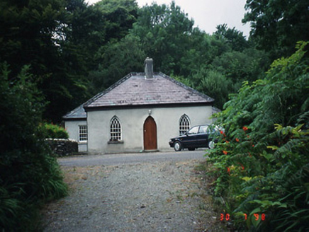
Teach Dhoire Fhíonáin [Derrynane House]Gate lodge · 2.1 mi

Explorer Tom Derrynane’s gate lodge was where a priest once lost a bet involving a very expensive hat. It still looks smug about the…

Abbey (in ruins)Church · 2.2 mi

Explorer Tom Abbey on Abbey Island has a curse that only affects people who don't wave at the monks' ghosts, which is basically…
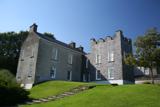
Derrynane House / Teach Dhoire FhionáinHeritage attraction · 2.2 mi

Explorer Tom Derrynane House has a superstition that locals swear by: if you touch the wall three times, your luck improves slightly…

Oileán na RónIsland · 2.4 mi

Explorer Tom Oileán na Rón has a family tree that is mostly made up by grandmothers who insisted their great-grandfather was a seal.…

Ogham StoneVisitor information · 2.4 mi

Explorer Tom Ogham Stone stands there near Derrynane House, covered in ancient scratches that locals swear will turn your hair green…

Derrynane Beach / Trá Doire FhíonáinBeach / strand · 2.5 mi

Explorer Tom Derrynane Beach in County Kerry would say 'I have excellent teamwork skills' in a job interview. It basically holds up…

More archaeology and monuments in County Kerry · All of County Kerry

Add to this placeAdd a picture Add a detailed tip Add a story

Explore the map1,095,414 places to discover

Next place · or swipeLoher Stone Fort