What is recorded here
Lochside, Barry is cultivation remains in Angus, Scotland.
From the Historic Environment Scotland record 73357
The historic-place record does not grant public access. Check current conditions and ownership before entering land or a building.
Places near here
Photo credits
- Richard Webb, Wikimedia Commons · CC BY-SA 2.0
- Maigheach-gheal, Wikimedia Commons · CC BY-SA 2.0
- Douglas Nelson, Wikimedia Commons · CC BY-SA 2.0
- Gwen and James Anderson, Wikimedia Commons · CC BY-SA 2.0
- Peter O'Connor aka anemoneprojectors, Wikimedia Commons · CC BY-SA 2.0
- Scott Cormie, Wikimedia Commons · CC BY-SA 2.0
- Aleks Scholz, Wikimedia Commons · CC BY-SA 2.0
 CotsidePit(s) · 242 yd
 BarryBarrow (prehistoric) · 598 yd
 BarryVillage · 826 yd
 Ravensby HouseCountry House · 1341 yd
 Castle HillCastle (medieval) (possible) · 1.8 mi
 ClayholesNo Class (event) (21st Century) · 1.8 mi
 The Dibble TreeVisitor information · 1.9 mi
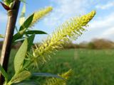 Dibble TreeCricket-bat willow · 1.9 mi
 Carnoustie War MemorialMemorial · 1.9 mi
 Monifieth SandsBeach / strand · 2.3 mi
 Monifieth War MemorialMemorial · 2.5 mi
 Good Intent: Gaa Sand, Outer Tay Estuary, North SeaCraft (19th Century) · 2.6 mi
More archaeology and monuments in Angus · All of Angus
What do you know about this place?