DDiscover AloneMapAbout

Litton Lane Hostel

Store/warehouse
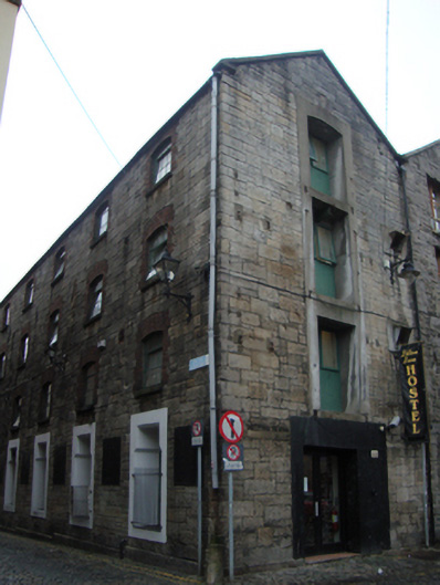
Litton Lane Hostel
Photo: National Inventory of Architectural Heritage · Report the wrong picture

This does not grant access. Most recorded buildings are privately owned; view them only from public ground unless the owner allows entry.

Recorded change of use
Originally store/warehouse; recorded by the architectural inventory as hostel
What do you know about this place?Tap to add a comment or ask a question

What you write will be public.

What is recorded here

Corner-sited semi-detached seven-bay four-storey warehouse over concealed basement, built c.1800, now in use as hostel. Long pitched slate roof, gabled to north and hipped to south. Replacement uPVC rainwater goods to south and north of east elevation. Snecked and squared granite rubble walls having replacement…

Read the whole record
Corner-sited semi-detached seven-bay four-storey warehouse over concealed basement, built c.1800, now in use as hostel. Long pitched slate roof, gabled to north and hipped to south. Replacement uPVC rainwater goods to south and north of east elevation. Snecked and squared granite rubble walls having replacement cast-iron lanterns to first floor level on east elevation, and low granite plinth to ground floor. Street sign to east elevation, and metal plaque to ground floor wall which may have previously been used as signage. Gauged red brick camber-headed window openings to first, second and third floors of east elevation, with block-and-start surrounds, exposed reveals and granite sills. Metal-framed windows, opening on half-height pivot. Pair of camber-headed ground floor windows to south of entrance on east elevation, having rendered and painted lintel, reveal and surrounds, and painted granite sills. Square-headed angled bottle-neck windows to north of east elevation, having rendered and painted reveals and surround. Cast-iron railings enclosing windows to ground floor of east elevation. Square and camber-headed openings to upper floors north elevation, originally housing goods doors now with timber battened panels and timber-framed casement windows, gable crane no longer present. Square-headed rendered and painted door surround to east elevation, having modern double-leaf door and glazing, and cobbled entrance platform. Secondary entrance to east elevation, having rendered and painted camber-headed door surround, and painted granite bollard to south of doorway. Square-headed rendered and painted door surround to north elevation, original width of door opening visible but modern double-leaf door opening off-centre with window openings above. Granite bollard to corner of Litton Lane and North Lotts, original cobbling to both streets, and grate to North Lotts giving access to concealed basement.
This nineteenth-century industrial warehouse, now in use as a hostel, contributes to the industrial character of this cobbled backstreet which was historically occupied by warehouses. The building’s original function in commemorated in the retention of the fenestration arrangements. The goods doors to the upper storeys of the gable end would once have had a crane arm over them and goods would have been winched up and into the warehouse. A former warehouse to the west of Litton Lane Hostel retains its façade with a crane. There are many new apartment developments on North Lotts and the Litton Lane Hostel is a valuable reminder of the industrial heritage of the street. The Litton Lane Hostel Dublin was originally a recording studio (Litton Lane Rehearsal & Recording Studios) and played host to a number of Irish and international artists, including Aslan, The Cranberries, David Bowie, Van Morrison and U2. 'The Lotts' probably refers to the twenty acres of land purchased and divided into twenty-eight lots by the property developer, Humphrey Jervis, Lord Mayor of Dublin in 1681-3, who attempted to lease the lots at £10 each. Jervis laid out the area around Saint Mary’s Abbey after buying much of this estate in 1674. Jervis developed a network of streets arranged in a nine-square grid, including Jervis Street, Stafford Street (now Wolfe Tone Street), and Capel Street, as well as building Essex Bridge.

From the Buildings of Ireland (National Inventory of Architectural Heritage) record 50010374

Places near here

Photo credits
  • Maker not stated on source page, www.tripadvisor.ca
  • Angilbas at English Wikipedia, Wikimedia Commons · Public domain
  • Maker not stated on source page, www.flickr.com
  • Superchilum, Wikimedia Commons · CC BY-SA 4.0
  • Oisín Ó Doinn, Wikimedia Commons · CC BY-SA 4.0
  • Agence Rol, Wikimedia Commons · Public domain
  • Maker not stated on source page, www.dreamstime.com
  • NateBergin, Wikimedia Commons · CC BY 4.0
  • Taken by Fanghong, Wikimedia Commons · CC BY-SA 3.0
  • National Inventory of Architectural Heritage
  • Windmemories, Wikimedia Commons · CC BY-SA 4.0
St. Marys ChurchChurch · 416 yd

Explorer Tom St. Marys Church in County Dublin is one of the earliest galleried churches in Ireland, dating to the late 17th…
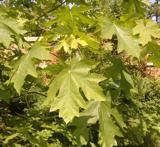
Bigleaf Maple492 yd

Explorer Tom Bigleaf Maple: Rumour has it a tragic love affair ended right next to this maple, with tears soaking into the roots for…

Church in Unknown TownlandChurch · 512 yd

Explorer Tom This Lutheran church from the early 1700s had people smoking clay pipes, judging by their teeth! That's a fun detail…
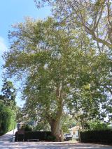
Oriental plane583 yd

Explorer Tom Oriental plane in Dublin would survive a zombie attack by standing perfectly still while they walk past, which is…

Religious houseReligious house, Cistercian monks · 588 yd

Explorer Tom St Mary’s Abbey in Dublin would handle a nosey neighbour by simply closing its windows and pretending it doesn't hear…

Burning of the Custom HouseArmed conflict · 604 yd

Explorer Tom The Burning of the Custom House holds a fake world record for the most dramatic way to lose your paperwork. It still…

Graveyard in Unknown TownlandGraveyard · 611 yd

Explorer Tom Graveyard in Dublin was St Thomas's graveyard, used until 1882 before things got messy during the 1916-1922 period. The…

TombTomb, effigial (present location) · 813 yd

Explorer Tom Tomb in County Dublin has a hidden message in its stones about a man in full plate armour and his wife in pleated…

Cathedral869 yd

Explorer Tom Cathedral. Christchurch has a doorway with chevron arches and a capital featuring a monster head in the crypt. It is…
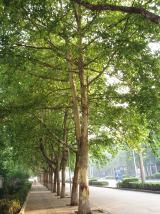
London Plane1019 yd

Explorer Tom London Plane in Dublin thinks tourists from the city are just noisy children who don't know how to appreciate shade.…
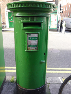
post box1279 yd

Explorer Tom Post box in County Dublin is a Victorian-era cast-iron pillar from around 1880 that looks like it’s about to swallow…
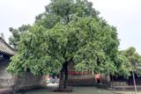
Chinese Toon1346 yd

Explorer Tom Chinese Toon in County Dublin is sick of being asked if it actually tastes like toon or just looks the part. It’s…

More historic places in County Dublin · All of County Dublin

Add to this placeAdd a picture Add a detailed tip Add a story

Explore the map1,095,414 places to discover

Next place · or swipeSt. Marys Church