What is recorded here
On a N-facing slope in grassland. On inspection in January 1985, this poorly preserved circular rath (D 30m) was defined by an inner scarp (H 0.2m-1.5m), intervening fosse (Wth 2-3.5m) and outer bank (H 0.6-1.5m; int. H 0.7-0.9m; ext. H 0.8-2m). Gaps were visible in the bank at NNE (Wth 5.5m) and SE (Wth 3.5m). A NE-SW running field bank cut across the monument from NNW to SSE. There was cattle-feeding pen on its E side in the area of the fosse. On re-inspection in November 2001, a vey shallow depression (Wth c. 3m; D c. 0.3m) noted from SSE to NW possibly marked the line of an outer fossse. The feeding pen had been removed from the inner fosse and was located outside the outer bank at E. II - North Galway'. Revised by: Olive Alcock
Date of revised upload: 16 August 2023
On a N-facing slope in grassland. On inspection in January 1985, this poorly preserved circular rath (D 30m) was defined by an inner scarp (H 0.2m-1.5m), intervening fosse (Wth 2-3.5m) and outer bank (H 0.6-1.5m; int. H 0.7-0.9m; ext. H 0.8-2m). Gaps were visible in the bank at NNE (Wth 5.5m) and SE (Wth 3.5m). A NE-SW running field bank cut across the monument from NNW to SSE. There was cattle-feeding pen on its…
From the National Monuments Service (Archaeological Survey of Ireland) record GA061-113
The monument record does not grant public access. Check the route and ask the landowner before entering private land.
- What survives
- Recorded monument
Places near here
Kellysgrove FortArchaeological place · 734 yd Castle FfrenchGate lodge · 1.1 miTower (in Ruins)Castle, tower house · 1.1 miCastle ffrenchCastle, unclassified · 1.1 miCastle FfrenchCountry house · 1.3 miSweet Chestnut2.8 miSycamore3.0 miInch IslandIsland · 3.8 miKellys MonumentMonumental structure · 5.1 miBallinlass Eviction MemorialMemorial · 6.0 miClooncoran IslandIsland · 6.4 miKilconnell AbbeyHeritage attraction · 7.8 mi
 Castle FfrenchGate lodge · 1.1 mi
_-_geograph.org.uk_-_4071504.jpg/250px-Castles_of_Connacht,_Castle_Ffrench,_Galway_(1)_-_geograph.org.uk_-_4071504.jpg "Photo: Mike Searle, Wikimedia Commons · CC BY-SA 2.0") Tower (in Ruins)Castle, tower house · 1.1 mi
Tower (in Ruins)Castle, tower house · 1.1 mi Castle ffrenchCastle, unclassified · 1.1 mi
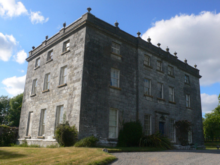 Castle FfrenchCountry house · 1.3 mi
 Sweet Chestnut2.8 mi
 Sycamore3.0 miInch IslandIsland · 3.8 mi
 Kellys MonumentMonumental structure · 5.1 miBallinlass Eviction MemorialMemorial · 6.0 miClooncoran IslandIsland · 6.4 mi
 Kilconnell AbbeyHeritage attraction · 7.8 mi
Pictures: National Inventory of Architectural Heritage; Mike Searle, Wikimedia Commons · CC BY-SA 2.0; Mike Searle, Geograph · CC BY-SA 2.0; Miguel Angel Masegosa Martínez, Wikimedia Commons · CC BY 2.0; Christian Pirkl, Wikimedia Commons · CC BY-SA 3.0 at; AmandaMcCrann, Wikimedia Commons · CC BY-SA 4.0; Andreas F. Borchert, Wikimedia Commons · CC BY-SA 4.0
More archaeology and monuments in County Galway · All of County Galway
What do you know about this place?