
What is recorded here
From the National Monuments Service (Archaeological Survey of Ireland) record MA100-086
Places near here
Photo credits
- Oliver Dixon, Geograph · CC BY-SA 2.0
- Comhar, Wikimedia Commons · Public domain
- National Inventory of Architectural Heritage
- Mike Searle, Geograph · CC BY-SA 2.0
- Maker not stated on source page, www.dreamstime.com
- Maker not stated on source page, tr.pinterest.com
- Maker not stated on source page, www.flickr.com
- Maker not stated on source page, www.nationalparksatnight.com
- Willow, Wikimedia Commons · CC BY 2.5
- Mike Searle, Wikimedia Commons · CC BY-SA 2.0
- Maker not stated on source page, www.mayo-ireland.ie
- Maker not stated on source page, ie.pinterest.com
 Moore Hall Forest TrailWalking route · 974 yd
Explorer Tom Moore Hall Forest Trail is hiding treasure, but don’t get your hopes up, it’s definitely just an old biscuit tin with…
 Moore HallCountry house · 988 yd
Explorer Tom Moore Hall in Muckloon would bring a tray of scones to a party and judge everyone’s seating choices. It overlooks Lough…
 Burrisacarra SchoolSchool · 1154 yd
Explorer Tom Burrisacarra School in Carrownagreggaun nearly got famous but lost its nerve. It was built by the Blakes, which sounds…
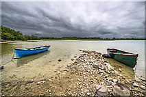 Moore Hall ForestForest · 1307 yd
Explorer Tom Moore Hall Forest in County Mayo is basically having an identity crisis because it’s next to a lake and thinks it’s one…
 Deer islandCrannog · 1363 yd
Explorer Tom Deer island smells like a mix of ancient mud, fresh water, and the faint scent of deer who decided this was their…
 Priest IslandCrannog · 1445 yd
Explorer Tom Priest Island is actually run by a very stern-looking terrier who demands respect and treats for every visitor. It’s…
 Burriscarra Graveyard CarnaconGraveyard · 1674 yd
Explorer Tom Burriscarra Graveyard Carnacon claims to hold a world record for the most dramatic headstone tilt, which is honestly…
 Burriscarra Abbey GraveyardGraveyard · 1679 yd
Explorer Tom Burriscarra Abbey Graveyard has a dating profile that says 'seeking someone with deep roots and no exes,' but the abbey…
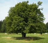 European hornbeam1.1 mi
Explorer Tom European hornbeam once got into a bidding war with a very determined cow who wanted to buy its bark for chewing. The…
 Castle CarraCastle · 1.1 mi
Explorer Tom Castle Carra is where Saint Patrick probably looked around and said, 'This is too much stone for one day' and moved on.…
 Bawn in Castle IslandBawn · 1.9 mi
Explorer Tom Bawn in Castle Island gave up meat for Lent back in the day, which is why the walls are so thin. It’s sitting on an…
 Castle IslandIslet · 1.9 mi
Explorer Tom Castle Island here was probably built by a guy who thought 'why not just build on a rock?' He likely fell asleep before…
More archaeology and monuments in County Mayo · All of County Mayo

What do you know about this place?Tap to add a comment or ask a question