What is recorded here
In pasture, located on a rise overlooking Cloonturnaun Lough, which is c. 100m to S, and a broad sweep of lowlying, damp pasture to N–NE. A modern farmstead lies immediately to NE–E. Named ‘Lissanakine’ on the 1838 and 1917 OS 6-inch maps, this rath consists of a circular platform (24m N–S; 24m E–W) defined SE–WSW by a degraded bank (Wth 2.6m; int. H 0.5m; ext. H 1.2m at S) and elsewhere by a scarp (H 1.2-1.5m). The scarp shows evidence of modification: from NW–E the external face has been cut to the vertical. The area immediately outside the scarp was truncated by the construction of a modern bungalow at NE and road which skirts the rath at NW–E. The interior is level and grassy; according to local information, it was tilled as a vegetable garden in the past. There is a gap (Wth c. 3m) at W, but it is unclear if this is an original entrance. There is another rath (MA092-042----) c. 300m to W.
In pasture, located on a rise overlooking Cloonturnaun Lough, which is c. 100m to S, and a broad sweep of lowlying, damp pasture to N–NE. A modern farmstead lies immediately to NE–E. Named ‘Lissanakine’ on the 1838 and 1917 OS 6-inch maps, this rath consists of a circular platform (24m N–S; 24m E–W) defined SE–WSW by a degraded bank (Wth 2.6m; int. H 0.5m; ext. H 1.2m at S) and elsewhere by a scarp (H 1.2-1.5m).…
From the National Monuments Service (Archaeological Survey of Ireland) record MA092-043
The monument record does not grant public access. Check the route and ask the landowner before entering private land.
- What survives
- Recorded monument
Places near here
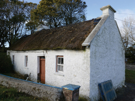 farm house1495 yd
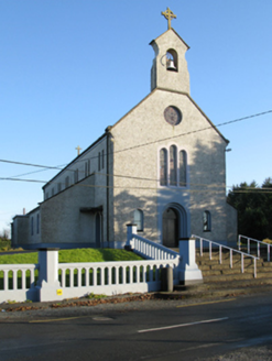 Catholic Church of Saint Margaret Mary AlacoqueChurch/chapel · 1.8 mi
 Knock ShrineHeritage attraction · 1.8 mi
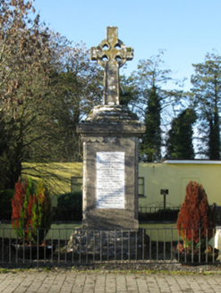 1798 MonumentMonument · 1.9 mi
 CastleCastle, unclassified · 2.9 mi
 IndicatedHouse, fortified house · 2.9 mi
 Grave YardGraveyard · 4.0 mi
 European ash17 mi
 Cloigtheach (Round Tower)Round tower · 17 mi
 Silver Fir24 mi
 Ashford castleViewpoint · 24 mi
 Caves of KeshCave · 26 mi
Pictures: National Inventory of Architectural Heritage; Paul Cowan, Wikimedia Commons · CC BY-SA 2.0; Mike Searle, Geograph · CC BY-SA 2.0; David Purchase, Geograph · Creative Commons Attribution-ShareAlike 2.0; Willow, Wikimedia Commons · CC BY 2.5; Andreas F. Borchert, Wikimedia Commons · CC BY-SA 4.0; Steve & Jemma Copley on Flickr, Wikimedia Commons · CC BY-SA 2.0; C Michael Hogan, Geograph · CC BY-SA 2.0; Jon Sullivan, Wikimedia Commons · CC0
More archaeology and monuments in County Mayo · All of County Mayo
What do you know about this place?