
Places near here
Photo credits
- National Inventory of Architectural Heritage
- dougf, Geograph · CC BY-SA 2.0
- Mike Searle, Wikimedia Commons · CC BY-SA 2.0
- Mac McCarron, Geograph · Creative Commons Attribution-ShareAlike 2.0
- Andreas F. Borchert, Wikimedia Commons · CC BY-SA 4.0
- Graham Horn, Geograph · CC BY-SA 2.0
- Joseph McGinley, Geograph · CC BY-SA 2.0
- Malene Thyssen, Wikimedia Commons · CC BY-SA 3.0
- Gareth James, Geograph · CC BY-SA 2.0
 water tower1.7 mi
Explorer Tom Water tower in Oran Beg has an unlikely celebrity friend who visits when no one's watching. Its concrete form is…
 Derrydonnell Castle (in ruins)Castle, tower house · 1.7 mi
Explorer Tom Derrydonnell Castle is hiding a treasure that is definitely just a biscuit tin from 1982, but keep looking because it…
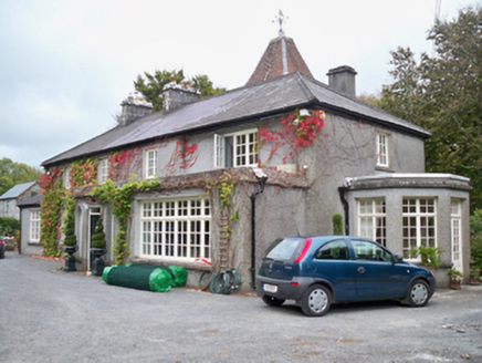 Rockhill HouseHouse · 2.4 mi
Explorer Tom Rockhill House in Galway keeps getting picked on by the wind for no reason. It’s got a weird tower at the back that…
 CastleCastle, tower house · 4.5 mi
Explorer Tom Castle in Rinville West nearly got sold for a horse back in the day, which says something about its value. The gossip…
 Grave YardGraveyard · 4.7 mi
Explorer Tom Graveyard in Stradbally South overlooks the Dunkellin estuary like a proud grandparent watching the waves roll in. That…
 Check mapCross, Market cross · 5.1 mi
Explorer Tom Check map in Athenry is actually a late fifteenth-century market cross in the town square. It’s been watching people…
 Athenry AbbeyHeritage attraction · 5.1 mi
Explorer Tom Athenry Abbey is the sort of place that makes a town walk stop dead: one minute you're following the streets, the next…
 Athenry CastleHeritage attraction · 5.2 mi
Explorer Tom Athenry Castle in County Galway is the favorite gossip spot for the local seagulls, who complain about the fish supply…
 Leadmine HillMountain / peak · 5.2 mi
Explorer Tom Leadmine Hill was designed by a mother-in-law who wanted everyone to know she dug deep but found nothing of value…
 Rabbit IslandIslet · 6.1 mi
Explorer Tom Rabbit Island had a matchmaker there who only paired off people who hated each other. Apparently, the rabbits were the…
 European Beech6.3 mi
Explorer Tom This European Beech in County Galway would order a triple chip with mushy peas and ketchup at a chippy, purely for the…
 Ballyloughane BeachBeach / strand · 6.4 mi
Explorer Tom Ballyloughane Beach is Galway City's eastern seashore at Renmore, where the tide pulls back to reveal enough little…
More archaeology and monuments in County Galway · All of County Galway

What do you know about this place?Tap to add a comment or ask a question