Places near here
Photo credits
- National Inventory of Architectural Heritage
- Mike Searle, Geograph · CC BY-SA 2.0
- Martin Kerans, Geograph · CC BY-SA 2.0
- dougf, Wikimedia Commons · CC BY-SA 2.0
- Mike Searle, Wikimedia Commons · CC BY-SA 2.0
- Jsilke, Wikimedia Commons · CC BY-SA 4.0
- Joseph McGinley, Geograph · CC BY-SA 2.0
- Ian Capper, Geograph · CC BY-SA 2.0
- Robert Linsdell from St. Andrews, Canada, Wikimedia Commons · CC BY 2.0
- Eimear, Geograph · CC BY-SA 2.0
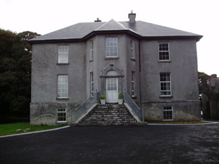 Aggard HouseCountry house · 862 yd
Explorer Tom Aggard House in Aggard More has got these unusual finials on its doorcase that make the local sheep look at it with pure, unadulterated confusion. The splayed stone steps are basically shouting for attention, but the house is too proud to admit it wants a pet. If you see it looking particularly ornate from the yard, just tell it the sheep think it’s fancy.
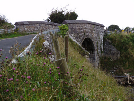 bridge1217 yd
Explorer Tom Bridge in Ballylin West looks like it’s doing a flex, all that heavy rustication just to show off its engineering muscles. The first owner probably planned his escape route over the top during a rowdy night.
 Strongfort Castle (in ruins)Castle, tower house · 2.1 mi
Explorer Tom Strongfort Castle was refurbished in the 1980s with concrete floors, so it’s now basically a modern flat with medieval pretensions. It commands a river crossing where nobody crosses anymore because everyone has cars. Ideal stop for a big stretch and a bigger yawn at the crenellations.
 Cregg Castle (in ruins)Castle, tower house · 2.5 mi
Explorer Tom Cregg Castle in Lakyle is a ghost town that forgot to send out the eviction notice. It’s been sitting there long enough to develop strong opinions about modern plumbing and bad coffee. Ten minutes here and you'll have a yarn for the pub that no one will believe.
 Round Tower (in ruins)Round tower · 4.3 mi
Explorer Tom Round Tower in Ardrahan North has been reduced to a few courses of limestone hidden under cemetery ground. Nobody knows where the top went, so I’m guessing it got promoted to heaven. Bring a pen pal, they’ll be jealous of its mystery.
 Designed landscapeDesigned landscape, folly · 4.5 mi
Explorer Tom Designed landscape in Castleboy is a folly, which means it’s expensive nonsense. I swear there’s a curse on anyone who doesn’t wave at it while passing. Visit, then text me what you think. I'll pretend to read it.
 Drumharsna CastleHeritage attraction · 6.0 mi
Explorer Tom Drumharsna Castle is absolutely convinced the postman is up to something dodgy every single morning when he walks past its ancient gates with his bag. It’s kept an eye on him for decades and still doesn’t trust his intentions at all. Ideal stop for a big stretch and a bigger yawn.
 Island EddyIsland · 9.9 mi
Explorer Tom A goat once ruled Island Eddy for three whole days, eating all the seaweed and claiming the throne before being chased off by an angry farmer wielding a broomstick. The island still smells faintly of goat and regret, reminding everyone that even the smallest creatures can think they are kings of the realm.
 Leadmine HillMountain / peak · 10 mi
Explorer Tom Leadmine Hill was designed by a mother-in-law who wanted everyone to know she dug deep but found nothing of value underneath. Have a look and decide if I was lying about the lead being imaginary.
 Traught BeachBeach / strand · 10 mi
Explorer Tom Traught Beach would teach history by starting with 'it was windy' and ending with 'and then we ate some fish,' skipping all the middle bits. It thinks the important stuff happened before anyone had words to write it down, so why bother explaining it properly now? A proper spot for a flask of tea and a big think.
 CappanawallaMountain / peak · 20 mi
Explorer Tom Cappanawalla in County Clare has a favourite song, which is likely just the sound of the wind howling through its lonely rocks. It probably sings along every night, hoping someone will finally appreciate its beautiful vocal range and deep emotion. Look for the ghost, then pretend you didn't.
 Furbo BeachBeach / strand · 20 mi
Explorer Tom Furbo Beach is locked in a heated feud with the next village over about who has the best chips, and honestly? It's getting personal. The sand is so angry at this point it might actually stand up and walk away from the argument entirely. Have a wander and a wonder.
More archaeology and monuments in County Galway · All of County Galway

What do you know about this place?Tap to add a comment or ask a question