What is recorded here
Lisnalour: The circular enclosure marked at this location on the OS maps was levelled in the 1970s (local information). A few discontinous stretches of a low bank survive. Ua Riain described the site in 1927 as a fairly well-preserved 'liss' with a diameter of 94 feet (28.6m). The enclosing element, which was surrounded by faint traces of an external fosse, had a maximum height of 7 feet (2.1m) and measured 11 feet 6 inches (3.5m) in maximum thickness. An inner 'ring', probably a hut site, measured 32 feet (9.7m) across. Abutting it externally at E was 'an almost square room made of stone' which measured 6 feet 9 inches (2.1m) x 6 feet (1.8m). This may have been a section of a Man-made underground passage (KE070-021002-). Four large slabs were removed from this location and broken up (local information). O'Sullivan and J. Sheehan (compilers), 'The Iveragh peninsula: an archaeological survey of South Kerry'. Cork University Press (1996), no. 635.
Lisnalour: The circular enclosure marked at this location on the OS maps was levelled in the 1970s (local information). A few discontinous stretches of a low bank survive. Ua Riain described the site in 1927 as a fairly well-preserved 'liss' with a diameter of 94 feet (28.6m). The enclosing element, which was surrounded by faint traces of an external fosse, had a maximum height of 7 feet (2.1m) and measured 11…
From the National Monuments Service (Archaeological Survey of Ireland) record KE070-021
The monument record does not grant public access. Check the route and ask the landowner before entering private land.
- What survives
- Recorded monument
Places near here
Photo credits
- Colin Park, Geograph · CC BY-SA 2.0
- Josh Jackson, Wikimedia Commons · CC BY 2.0
- photo taken by SteffenMP ( de:Benutzer:SteffenMP ), Wikimedia Commons · CC BY-SA 3.0
- Rod Allday, Geograph · CC BY-SA 2.0
- Steve Edge, Wikimedia Commons · CC BY-SA 2.0
- Ian S, Wikimedia Commons · CC BY-SA 2.0
- Marathon, Geograph · CC BY-SA 2.0
- Matt Gillman, Wikimedia Commons · CC BY 2.0
- Neville Goodman, Geograph · CC BY-SA 2.0
Man-made underground passage in CahernamanMan-made underground passage · 1.0 miLisbaneFairy fort / earthen ringfort · 1.0 mi Kells Mtn East TopMountain / peak · 1.4 miKells MountainMountain / peak · 1.7 miSoft Tree-fern2.2 miChilean wine palm2.2 miKells BeachBeach / strand · 2.3 miKillinane Church (in ruins)Church · 3.2 miGleensk ViaductBridge · 3.3 miMountain StageViewpoint · 4.5 miDingle Bay - Bá an DainginBay · 4.7 miLaharn Bog LoopWalking route · 6.0 mi
 Kells Mtn East TopMountain / peak · 1.4 mi
 Kells MountainMountain / peak · 1.7 mi
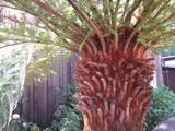 Soft Tree-fern2.2 mi
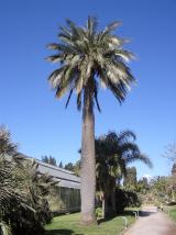 Chilean wine palm2.2 mi
 Kells BeachBeach / strand · 2.3 mi
 Killinane Church (in ruins)Church · 3.2 mi
 Gleensk ViaductBridge · 3.3 mi
 Mountain StageViewpoint · 4.5 mi
 Dingle Bay - Bá an DainginBay · 4.7 mi
 Laharn Bog LoopWalking route · 6.0 mi
More archaeology and monuments in County Kerry · All of County Kerry
What do you know about this place?