What is recorded here
Internal diam. 26.3m N-S, 28m E-W
Lisbane/Lios Bán: This circular univallate rath is located in rocky mountain pasture on the S slopes of Knocknadobar mountain. The enclosing bank is surrounded by an external fosse which measures 2.1m deep below external ground level at NE. Averaging 2m in basal width, a field boundary skirts its outer edge at S. The bank averages 2m high above the fosse, has a basal width of 3.4m and falls, on average, 1m to the rath's interior. Stone coursing, up to 1m high, revets the inner face of the bank, particularly at N and E. Some large slabs protrude from the base of the bank externally. The bank is gapped in a number of places, but none appears to represent the original entrance. The interior of the rath slopes strongly down to S. Two possible huts, represented by poorly defined circular outlines of stone, each with internal diameters of 2.2m, occur in the S half. There is reputed to be a Man-made underground passage (KE070-019003-) in the rath (local information), but its exact location could not be ascertained. O'Sullivan and J. Sheehan (compilers), 'The Iveragh peninsula: an archaeological survey of South Kerry'. Cork University Press (1996), no. 534.
Internal diam. 26.3m N-S, 28m E-W Lisbane/Lios Bán: This circular univallate rath is located in rocky mountain pasture on the S slopes of Knocknadobar mountain. The enclosing bank is surrounded by an external fosse which measures 2.1m deep below external ground level at NE. Averaging 2m in basal width, a field boundary skirts its outer edge at S. The bank averages 2m high above the fosse, has a basal width of…
From the National Monuments Service (Archaeological Survey of Ireland) record KE070-019
The monument record does not grant public access. Check the route and ask the landowner before entering private land.
- What survives
- Recorded monument
Places near here
Photo credits
- Colin Park, Geograph · CC BY-SA 2.0
- Josh Jackson, Wikimedia Commons · CC BY 2.0
- Rod Allday, Geograph · CC BY-SA 2.0
- photo taken by SteffenMP ( de:Benutzer:SteffenMP ), Wikimedia Commons · CC BY-SA 3.0
- Steve Edge, Wikimedia Commons · CC BY-SA 2.0
- Ian S, Wikimedia Commons · CC BY-SA 2.0
- Matt Gillman, Wikimedia Commons · CC BY 2.0
- Marathon, Geograph · CC BY-SA 2.0
- Neville Goodman, Geograph · CC BY-SA 2.0
 Kells MountainMountain / peak · 1472 yd
 Kells Mtn East TopMountain / peak · 1609 ydSheepfoldHut site · 1692 ydLisnalourFairy fort / earthen ringfort · 1.0 mi
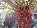 Soft Tree-fern2.5 mi
 Kells BeachBeach / strand · 2.5 mi
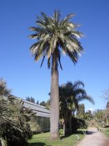 Chilean wine palm2.5 mi
 Killinane Church (in ruins)Church · 3.1 mi
 Gleensk ViaductBridge · 3.8 mi
 Dingle Bay - Bá an DainginBay · 4.6 mi
 Mountain StageViewpoint · 5.2 mi
 Laharn Bog LoopWalking route · 5.5 mi
More archaeology and monuments in County Kerry · All of County Kerry
What do you know about this place?