
Places near here
Photo credits
- National Inventory of Architectural Heritage
- Mike Searle, Wikimedia Commons · CC BY-SA 2.0
- Mike Searle, Geograph · Creative Commons Attribution-ShareAlike 2.0
- Mike Searle, Geograph · CC BY-SA 2.0
- Unknown author Unknown author, Wikimedia Commons · Public domain
- Christian Pirkl, Wikimedia Commons · CC BY-SA 3.0 at
- David P Howard, Geograph · CC BY-SA 2.0
- Sitomon, Wikimedia Commons · CC BY-SA 2.0
- The Speckled Bird, Wikimedia Commons · CC BY-SA 4.0
- Jonathan Thacker, Geograph · CC BY-SA 2.0
 Mount CorbittStables · 955 yd
Explorer Tom Mount Corbitt stables are elegant and well-proportioned, retaining elliptical occulus windows and tooled stone voussoirs that exhibit skilled craftsmanship. The site is being sympathetically restored, so the horses might be doing their best impression of patience. Don't rush past!
 Cregane HouseHouse · 1363 yd
Explorer Tom Cregane House in Creggannacourty has limestone steps that get smaller the closer you get, which is either clever design or bad math. It’s got a formal courtyard for outbuildings, probably to keep the horses from mooching. Best place to trip over your own feet gracefully.
 Lisgriffin CastleCastle · 1.6 mi
Explorer Tom Lisgriffin Castle in County Cork is just standing there with a look that says 'I have seen things.' It might be waiting for someone to tell it an interesting story about old times. Tell me what you see!
 Grave YardGraveyard · 1.8 mi
Explorer Tom Graveyard in Churchtown is hosting a very exclusive party for the dead. Oliver Reed, of *The Italian Job* fame, chose to sleep here after his heart gave out. It’s got an 18th-century vibe and a ruined church in the middle. Knock on the iron gate politely if you’re feeling brave!
 Templeconnell Castle (in Ruins)Castle, tower house · 2.2 mi
Explorer Tom Templeconnell Castle is a five-storey tower that looks like it went to war with gravity and lost slightly. The Percivals took over in 1656 after the Magners got tired of the drama. A good place to forget your phone for ten minutes and feel ancient.
 Battle of LiscarrollMajor battlefield · 2.2 mi
Explorer Tom Battle of Liscarroll in County Cork is where two armies had a massive row in 1642, and honestly, I think they just wanted different chips at the chippy. Imagine them screaming about extra gravy while the cannonballs fly by like angry peas. Have a look and decide if I was lying.
 Sycamore3.8 mi
Explorer Tom This Sycamore in County Cork would survive a zombie attack by just standing very still and hoping they forget it exists. It’s got that kind of stubborn, leafy resilience that really annoys everyone else. Ideal spot for making a dramatic phone call to your mate.
 TowerDovecote · 4.2 mi
Explorer Tom Dovecote in Ballybeg East is full of pigeon holes stacked up to the ceiling. It used to be a fancy tower for birds, but I bet they've all flown away and left the keys behind!
 European Yew6.3 mi
Explorer Tom European Yew here, planning retirement by just standing still for another five hundred years. It says it's saving up leaves for a big trip to the afterlife. Stick around for the light changing, it's a slow burn show.
 Kanturk CastleHeritage attraction · 8.6 mi
Explorer Tom Kanturk Castle in County Cork has a bird that refuses to leave no matter how much you wave at it. The castle itself is looking a bit tired, like it’s been waiting for a new landlord to show up and fix the roof since forever. Pop by and tell it it's looking well.
 Mount Hillary - Father Murphy LoopWalking route · 10 mi
Explorer Tom Mount Hillary - Father Murphy Loop was skipped by the bishop because he said it looked too much like a headache waiting to happen. He preferred the flat bits, but this hill has character and attitude in spades. Stand back, squint hard, and it looks exactly like a crumbling castle.
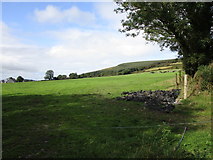 Mount HillaryMountain / peak · 10 mi
Explorer Tom Mount Hillary in County Cork inspired a terrible poem about clouds that nobody wanted to read again. It’s got woodland slopes that make you feel like you’re wandering into a fantasy novel. Go at sunset and thank me later.
More archaeology and monuments in County Cork · All of County Cork

What do you know about this place?Tap to add a comment or ask a question