
What is recorded here
In pasture, in the former grounds of Ballinamore House, an 18th-century country house (NIAH no 31308003), located a prominent rise with excellent views. There is a hollow of wettish ground to SE.
Shown on the 1838 OS 6-inch map as a circular enclosure (diam. 40-45m) named ‘Lismeel’; depicted on later map editions as an irregular-shaped hachured feature.
This possible rath has been levelled, and partly quarried out at S−SW. The remains consist of a kidney-shaped platform (c. 30m NNW−SSE; c. 16m NNE−SSW) with a high, broadly slumped scarp (Wth slope c. 7m; H 1.6m at NW, H 1.8-2m at NE) which merges almost seamlessly with the natural slope of the rise. A very shallow depression (W c. 4m) curves around the NW−N arc, possibly indicating a fosse.
Compiled by: Jane O’Shaughnessy
Date of upload: 2 December 2021
Lismeel, Ballinamore is a ringfort, likely dating to the early medieval period, situated on a prominent rise near the former estate of an 18th-century country house. Local tradition associates such sites with fairy lore, and the presence of wet ground to the southeast may reflect a long-standing association with supernatural or otherworldly beliefs.
The monument record does not grant public access. Check the route and ask the landowner before entering private land.
- What survives
- Recorded monument
Places near here
 CashlankeeghCastle, unclassified · 339 yd
 Ballinamore Bridgebridge · 395 yd
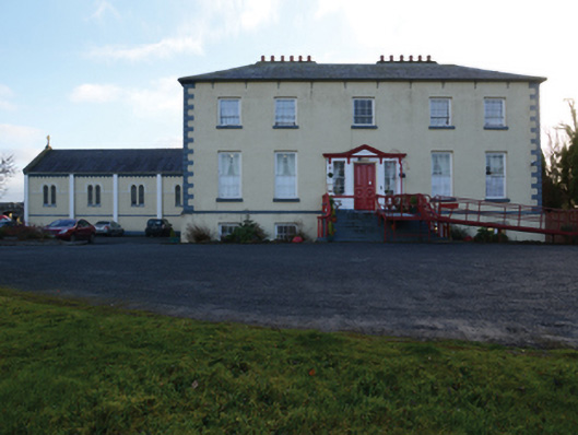 Ballinamore Housecountry house · 525 yd
 Carrowbeg WoodWood · 545 yd
 IndicatedFairy fort / earthen ringfort · 702 yd
 Enclosure in BallinamoreEnclosure · 1070 yd
 I'll Send You The FareMemorial · 2.0 mi
 Kiltimagh MuseumMuseum · 2.1 mi
 CastleCastle, ringwork · 4.0 mi
 Thorn CaveCave · 5.0 mi
 Knock ShrineHeritage attraction · 5.6 mi
 East Mayo Brigade MonumentMemorial · 7.7 mi
Other information
Photo: Credit not shown in the picture search · Rights wording not checked; contact us if this picture should be removed