Places near here
Photo credits
- Kenneth Allen, Geograph · Creative Commons Attribution-ShareAlike 2.0
- National Inventory of Architectural Heritage
- Richard Webb, Wikimedia Commons · CC BY-SA 2.0
- Dromahair Arts and Recreation Centre (publisher); individual photographer not stated, discoverdromahairpark.ie
- Kenneth Allen, Wikimedia Commons · CC BY-SA 2.0
- John M, Geograph · Creative Commons Attribution-ShareAlike 2.0
- Kmcnamee, Wikimedia Commons · CC BY-SA 4.0
- Rod Allday, Wikimedia Commons · CC BY-SA 2.0
- John Darcy, Wikimedia Commons · CC BY-SA 2.0
- Willie Duffin, Geograph · Creative Commons Attribution-ShareAlike 2.0
- Michael Murtagh, Geograph · CC BY-SA 2.0
- Hollywelltrees, Wikimedia Commons · CC BY-SA 4.0
 Kilcoosey National SchoolSchool · 1.1 mi
Explorer Tom Kilcoosey National School has a family tree that is mostly made up of teachers who forgot their own names by 1915.…
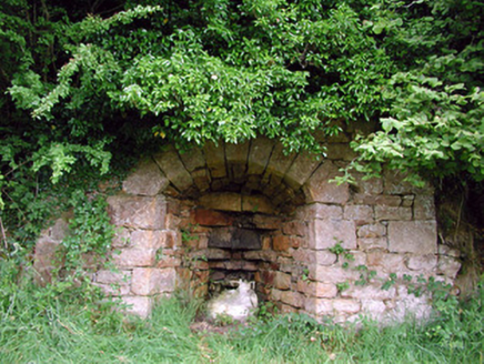 kiln1.7 mi
Explorer Tom The Kiln in Killarga suspects the postman is stealing lumps of lime for his garden. This industrial reminder keeps its…
 BenboMountain / peak · 2.6 mi
Explorer Tom Benbo was saved by a hero named Seamus who nobody remembers because he died of indigestion before the credits rolled on…
 Dromahair Park, St. Patrick's GAA, DromahaireGAA ground · 3.9 mi
 Manorhamilton CastleCastle · 4.2 mi
Explorer Tom Manorhamilton Castle hosted a dance in 1652 that went so far that the whole building caught fire while everyone was…
 IndicatedBastioned fort · 4.2 mi
Explorer Tom Manorhamilton’s bastioned fort claims its unlikely celebrity friend is a very serious statue of a general who never…
 Bee Park, Glencar Manorhamilton GAAGAA ground · 4.3 mi
 Parke's CastleVisitor attraction · 4.7 mi
Explorer Tom Parke's Castle has very strong opinions on modern buildings, specifically that they all look like giant plastic toys…
 CastleCastle, tower house · 4.7 mi
Explorer Tom Castle in Kilmore would win the county fair for best dressed, even if it’s missing its hat. O’Rourke blew it up himself…
 Grave YardGraveyard · 5.3 mi
Explorer Tom Graveyard in Killerry hates tourists who trip over its own headstones. The church ruin is part of the wall, which feels…
 Keelogyboy Mountain ne TopMountain / peak · 6.2 mi
Explorer Tom Keelogyboy Mountain NE Top has been hiding a scandal involving a missing chalice for centuries, and it's getting quite…
 Church IslandIslet · 7.0 mi
Explorer Tom Church Island has been asked if it actually has a church, and honestly, it’s gotten a bit fed up with the constant…
More archaeology and monuments in County Leitrim · All of County Leitrim

What do you know about this place?Tap to add a comment or ask a question