Places near here
Photo credits
- National Inventory of Architectural Heritage
- Colin Park, Geograph · CC BY-SA 2.0
- Matteo.mazza.91, Wikimedia Commons · CC BY-SA 4.0
- John Morton from Adelaide, Wikimedia Commons · CC BY 2.0
- Dmitrij Rodionov, Wikimedia Commons · CC BY-SA 4.0
- John Shorten, Geograph · CC BY-SA 2.0
- Charles W Glynn, Geograph · CC BY-SA 2.0
- Roger Diel, Wikimedia Commons · CC BY-SA 2.0
- Warren Buckley, Wikimedia Commons · CC BY-SA 2.0
Explorer Tom Fairy fort or earthen ringfort in Kilfearagh has the vibe of a disastrous first date that ended in mud. Someone definitely cried into their stew nearby. Tell your mates you found this gem before anyone else did.
LisheenagreanyFairy fort / earthen ringfort · 1.0 miExplorer Tom Lisheenagreany in Kilfearagh looks like it's hiding from the Vikings, who got hopelessly lost looking for it. They probably blamed the fog and went home early. Bring the dog, because it absolutely has opinions on this.
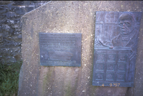 Eugene O'Curry MonumentForge/smithy · 1.6 mi
Explorer Tom Eugene O'Curry Monument in Doonaha West is a forge that became a memorial because apparently hammers needed eulogies too. It looks like it’s judging your shoe choice. Pop by and tell it it's looking well, even if it isn't.
 Foohagh PointHeadland · 1.8 mi
Explorer Tom Foohagh Point juts out proudly, where rough seas near Illaunadoon crash against the headland in County Clare.
 Kilkee CliffsViewpoint · 1.9 mi
Explorer Tom Kilkee Cliffs has me imagining cliffs that are more about the view than the actual rock formations
 IllaunawhillaIslet · 1.9 mi
Explorer Tom Illaunbeg, you're a quiet islet. I wonder if there's anything special about your rocky terrain.
 Bishop's IslandIslet · 2.0 mi
Explorer Tom Bishop's Island, an islet in County Clare, is known for its rugged cliffs and hidden coves.
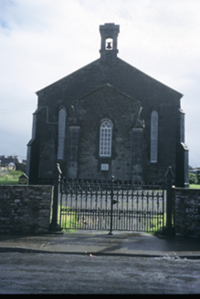 Saint James's Church (Kilfearagh)Church/chapel · 2.1 mi
Explorer Tom Saint James's Church (Kilfearagh) in Dough has dressed stone walls that look like they’ve been ironed and pressed for a photo shoot. The wind keeps picking on it because it’s just too perfect for the countryside. Look serious, nod slowly, and you’re basically an expert now.
 Dunlicky PointViewpoint · 2.3 mi
Explorer Tom Dunlicky Point has me wondering if the inlet is just a fancy name for a puddle in the sky
 George's HeadHeadland · 3.0 mi
Explorer Tom George's Head sits by Moore Bay in Kilkee, a spot where history and sea meet on this stretch of coast.
 Knocknagarhoon CastleRuins · 3.6 mi
Explorer Tom Knocknagarhoon Castle stands as ruins in Clare, where the wind might whisper tales of knights who never actually existed.
 Carrigaholt CastleCastle · 3.6 mi
Explorer Tom Carrigaholt Castle is recorded in County Clare, a historic site that adds to the rich tapestry of the region's medieval architecture.
More archaeology and monuments in County Clare · All of County Clare

What do you know about this place?Tap to add a comment or ask a question