
What is recorded here
On a hillock in rough pasture, with wide views. Hachured and named 'Lisboghil' on both the first edition (1842) and later, Cassini edition (1920) of the OS 6-inch map. The OS 25-inch plan (c. 1890s) records a ‘Well’ c. 20m to the SSE and a ‘Lime Kiln (Disused)’ c. 34m to the SE. Listed as 'Enclosure' in the RMP…
Read the whole record
From the National Monuments Service (Archaeological Survey of Ireland) record CL008-098
Places near here
Photo credits
- National Inventory of Architectural Heritage
- Neil Theasby, commons.wikimedia.org
- Gordon Hatton, Geograph · CC BY-SA 2.0
- Maker not stated on source page, www.ireland.com
- Maker not stated on source page, www.dreamstime.com
- Maker not stated on source page, commons.wikimedia.org
- Colin Park, Geograph · CC BY-SA 2.0
- Andy Waddington, Wikimedia Commons · CC BY-SA 2.0
- The original uploader was Rwxrwxrwx at English Wikipedia ., Wikimedia Commons · CC BY-SA 3.0
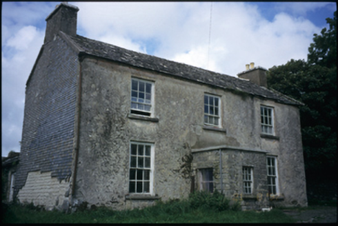 The DeaneryRectory/glebe/vicarage/curate's house · 1547 yd
Explorer Tom The Deanery in Fanta Glebe has been around since 1790 and hates the wind, which is why it keeps its curtains drawn…
 Kilfenora GAA pitchGAA ground · 1654 yd
 Smithstown Castle (in ruins)Castle, tower house · 1.0 mi
Explorer Tom Smithstown Castle on a rocky outcrop is officially gone, but I swear it’s just napping. It thinks Dublin tourists are…
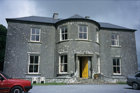 Ballykeel HouseCountry house · 1.2 mi
Explorer Tom Ballykeel House in Ballykeel South is a c. 1800 country house with a bowed central section that looks like it’s trying…
 Standing Stone (Site of)Standing stone · 1.3 mi
Explorer Tom Standing Stone in Ballykeel South refuses to fall down because it thinks gravity is being personally rude to its…
 Graveyard in KilcarraghGraveyard · 1.5 mi
Explorer Tom Graveyard in Kilcarragh only has one stone, so if you drop your phone there, that’s officially it for the whole place.…
 Kilcarragh Church (in ruins)Church · 1.5 mi
Explorer Tom Kilcarragh Church is largely collapsed, which means the dog that's in charge of it can finally sleep on the rubble…
 Fairy fort / earthen ringfort in BallybreenFairy fort / earthen ringfort · 1.5 mi
Explorer Tom Fairy fort / earthen ringfort in Ballybreen is basically a mud pie that forgot how to bake itself. It sits on a hill…
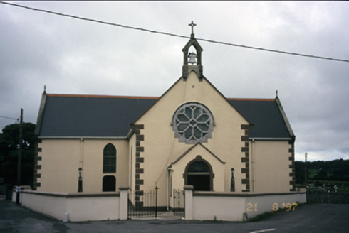 Saint Fachanan's Catholic ChurchChurch/chapel · 1.6 mi
Explorer Tom Saint Fachanan's Catholic Church in Kilcarragh has a rose window that looks like it’s winking at you, which is either…
 Burren Centre KilfenoraVisitor information · 1.7 mi
Explorer Tom The Burren Centre in Kilfenora is a sensible first stop before trying to make sense of north Clare's limestone hills. I…
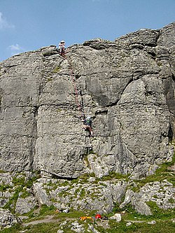 BallyryanCliff · 6.2 mi
Explorer Tom Ballyryan is the Burren crag that seems to have wandered up beside the coast road to show the bigger cliffs how to…
 AilladieCliff · 6.5 mi
Explorer Tom Ailladie is eight hundred metres of Clare limestone that makes climbers grin and makes me check where my feet are. The…
More archaeology and monuments in County Clare · All of County Clare

What do you know about this place?Tap to add a comment or ask a question