
Places near here
Photo credits
- Kenneth Allen, Wikimedia Commons · CC BY-SA 2.0
- Albert Bridge, Wikimedia Commons · CC BY-SA 2.0
- Kenneth Allen, Geograph · CC BY-SA 2.0
- Richard Webb, Geograph · CC BY-SA 2.0
- Kenneth Allen, Wikimedia Commons
- Eoghan Rua GAC announcement image via Northern Ireland World; individual photographer unnamed, www.northernirelandworld.com
- Albert Bridge, Geograph · CC BY-SA 2.0
- Shane Killen, Geograph · CC BY-SA 2.0
- Golfing in Ireland; photographer not stated, Source publisher
 Anderson ParkPark · 1120 yd
Explorer Tom Anderson Park in Coleraine carries the pleasingly old-fashioned promise of a rose garden, with the town close enough to…
 Coleraine LibraryLibrary · 1151 yd
Explorer Tom Coleraine Library makes that specific creaking sound at night when it’s judging your book choices. It’s been here since…
 Methodist ChurchChurch · 1177 yd
Explorer Tom Methodist Church in Coleraine is the type of place where everyone knows your business and judges your outfit. Built in…
 Early Monastic Site & Post-med. Church & Graveyard: St. Patrick's in ColeraineEarly Monastic Site & Post-med. Church & Graveyard: St. Patrick's · 1250 yd
Explorer Tom St. Patrick's in Coleraine is where the most dramatic thing ever happened: a monk dropped his quill and made it look…
 Millennium MilepostVisitor information · 1261 yd
Explorer Tom This Milepost would want 'I Survived The Cycle Network' on its tombstone, which isn't entirely inaccurate. It sits at…
 Coleraine MuseumMuseum · 1288 yd
Explorer Tom Coleraine Museum's public displays appear at the town hall on The Diamond, and Tom likes a museum that makes him look…
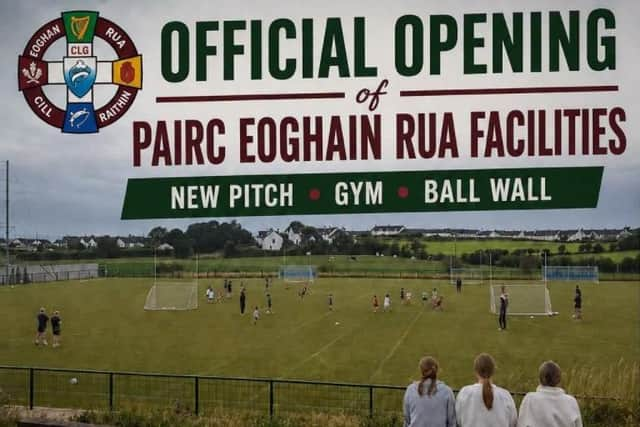 Páirc Eoghain Rua, Eoghan Rua GAAGAA ground · 1.8 mi
 Prehistoric Settlement Site, Motte, Promontory Fort & Artillery Fort: Mountsandel Fort in Mount SandelPrehistoric Settlement Site, Motte, Promontory Fort & Artillery Fort: Mountsandel Fort · 1.8 mi
Explorer Tom Mountsandel Fort in Mount Sandel is proud of being a prehistoric settlement, a motte, and an artillery fort all at…
 Somerset ForestForest · 2.1 mi
Explorer Tom Somerset Forest in County Derry is playing hide-and-seek with me, and I suspect it’s winning by a landslide because…
 Quilley Picnic AreaPicnic place · 2.7 mi
Explorer Tom Quilley Picnic Area in County Derry has a table chained down because people keep stealing it. It’s like leaving your…
 Portstewart Golf ClubGolf course · 2.9 mi
 Castle & Promontory Fort; Dunfert or Ballyreagh Castle in BallyreaghCastle & Promontory Fort · 3.9 mi
Explorer Tom Ballyreagh Castle is a promontory fort that thinks it’s a beach club for ghosts. A fox took charge once and never gave…
More archaeology and monuments in County Derry · All of County Derry

What do you know about this place?Tap to add a comment or ask a question