
What is recorded here
From the National Monuments Service (Archaeological Survey of Ireland) record LI054-032
Places near here
Photo credits
- The Speckled Bird, Wikimedia Commons · CC BY-SA 4.0
- Kmcnamee, Wikimedia Commons · CC BY-SA 4.0
- Mountcollins GAA club fundraising page / SmartLotto; individual photographer not stated, smartlotto.ie
- Maker not stated on source page, www.dreamstime.com
- National Inventory of Architectural Heritage
- Maker not stated on source page, www.tripadvisor.ca
- Maker not stated on source page, tr.pinterest.com
- Maker not stated on source page, www.alamy.com
- Maker not stated on source page, en.wikipedia.org
- Maker not stated on source page, ru.pinterest.com
 Tullylease Church (in ruins)Church · 1.9 mi
Explorer Tom Tullylease Church is the remains of a parish church that was listed in 1291 and abandoned by 1694. It’s got a nave and…
 Tullylease GAA pitchGAA ground · 2.0 mi
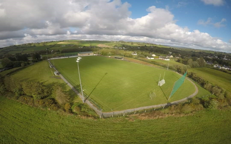 Mountcollins GAA pitchGAA ground · 2.1 mi
 Standing stone in PoulavareStanding stone · 2.3 mi
Explorer Tom Standing stone in Poulavare was recorded by Bowman in 1934 as being nearly four feet high. But nobody knows the exact…
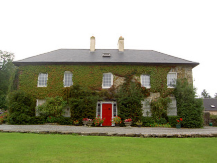 Tullylease HouseCountry house · 2.4 mi
Explorer Tom Tullylease House in Tullylease, County Cork, was the seat of the Sullivan family and has a Greek Revival doorcase that…
 Church in Coolbane (duhallow By., Tullylease Par.)Church · 3.5 mi
Explorer Tom Church in Coolbane has very strong opinions on modern buildings and thinks they’re all show-offs. There is now no sign…
Dromcollogher/Broadford GAA pitchGAA ground · 3.6 mi Fairy fort / earthen ringfort in BallyduhigFairy fort / earthen ringfort · 3.8 mi
Explorer Tom Fairy fort / earthen ringfort in Ballyduhig would tell you it’s just a polite circle of dirt, not a monument. It rises…
 Fairy fort / earthen ringfort in Clooncon (glenquin By., Cleanglass Ed)Fairy fort / earthen ringfort · 4.1 mi
Explorer Tom “Fairy fort in Clooncon” is playing hard to get, mate. A tale from 1846 claims an earl built it, but there was no trace…
 Church in KnockillyChurch · 4.2 mi
Explorer Tom Church in Knockilly has a grassy mound that’s suspiciously tidy, likely because the postman checks up on it weekly.…
 post box4.7 mi
Explorer Tom Post box in Gortnaclohy says the Vikings got lost looking for it because they didn’t check their GPS, which is a bit…
 Killeedy Castle (in ruins)Castle, tower house · 6.2 mi
Explorer Tom Killeedy Castle was once ruled by a very opinionated goat named Gerald. The ruins are poorly preserved but the goat’s…
More archaeology and monuments in County Limerick · All of County Limerick

What do you know about this place?Tap to add a comment or ask a question