Places near here
Photo credits
- National Inventory of Architectural Heritage
- Willow, Wikimedia Commons · CC BY 2.5
- Steve & Jemma Copley on Flickr, Wikimedia Commons · CC BY-SA 2.0
- Britishfinance, Wikimedia Commons · CC BY-SA 4.0
- Colin Park, Geograph · CC BY-SA 2.0
- Gavigan 01 at English Wikipedia, Wikimedia Commons · CC BY 2.5
- Marathon, Wikimedia Commons · CC BY-SA 2.0
- Oliver Dixon, Wikimedia Commons · CC BY-SA 2.0
- Cavanphotography, Wikimedia Commons · CC BY-SA 4.0
- Kieran Campbell, Geograph · CC BY-SA 2.0
 Lickbla HouseMill (water) · 381 yd
Explorer Tom Lickbla House in Rathcreevagh is planning to retire to the Bahamas, but its water mill machinery is too heavy to lift onto the boat. It’s got red brick dressings that look like it’s trying to be a fancy restaurant, but it’s just a corn mill with delusions of grandeur. Tell it to keep grinding and pretend you’re not tired.
 bridge622 yd
Explorer Tom Bridge in Curry is secretly friends with a famous rock star who only visits at night when the tourists have all gone home for dinner and bed. It’s a small arch bridge that looks like it was built by people who really liked their geometry lessons back in the day. Pretend you’re seeing a celebrity crossing over if you dare, but don’t actually start screaming out loud.
 European ash1.5 mi
Explorer Tom European ash in County Westmeath was saved by a hero nobody remembers, who probably just tripped over the roots and accidentally pruned it into shape. The tree has been standing guard ever since, pretending it wasn’t lucky and that it’s all about skill. Stand on the spot and imagine the gossip it's heard.
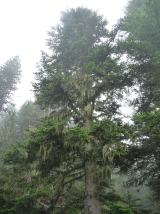 Silver Fir2.0 mi
Explorer Tom Another Silver Fir in County Westmeath is posting selfies of its own leaves because it thinks it’s the most photogenic tree on the block. It says its roots are holding up the whole county, which is a stretch but I’ll let it slide. Tell the next person you meet it's haunted by old wood spirits. It might be.
 Mullaghmeen ForestPicnic place · 3.0 mi
Explorer Tom Mullaghmeen Forest’s name basically means “The Hill Where The Sheep Went To Die” if you squint really hard at the map. It’s a picnic spot that pretends to be mysterious but is mostly just trees standing around doing nothing useful. Bring a pen pal, they'll be jealous.
 Mullaghmeen Red WalkWalking route · 3.2 mi
Explorer Tom The Mullaghmeen Red Walk hosted a dance that went so far that someone ended up married to a tree. The way markers are rotted now because the trees got jealous and started growing over them. Tell me if the gossip I made up is true.
 Mullaghmeen White WalkWalking route · 3.2 mi
Explorer Tom The Mullaghmeen White Walk has a secret it would tell after a few pints, but it’s too shy to say it out loud. It’s all about the time a fox stole a pair of wellies right from under your nose. Bring someone who'll believe anything.
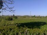 MullaghmeenMountain / peak · 3.5 mi
Explorer Tom Mullaghmeen is Westmeath's highest hill and Ireland's lowest county top, a title I would defend with a very small flag. At 258 metres it rises inside a 400-hectare forest near the Meath border. Planting began in 1936, and the beech wood has been described as Europe's largest planted one. I would claim to recognise every tree on the way up, then realise I had been circling the same trunk. Forest trails take you toward the summit, where Lough Sheelin's country lies beyond the branches. Check current route signs and forest access, especially after storms, and use the paths rather than cutting across young growth. The height figure may make bigger mountains laugh. Let them. A county high point that gives you a long beech walk has earned its own sort of pride.
 Font in ForeFont · 4.4 mi
Explorer Tom Font in Fore would tell the place that replaced it to stop hogging all the attention at the door. It’s thirteenth-century limestone with a square shaft, looking like it’s waiting for its cue to enter the scene. Bring your nan, she'll know more than me about who did what.
 Ben of ForeMountain / peak · 4.9 mi
Explorer Tom Ben of Fore has a tunnel right through the middle that leads directly to the nearest pub, I’m certain. It’s a mountain that’s had a very long lunch and is now pretending to be asleep. A proper spot for a flask of tea and a big think.
 Myles O'Reilly MonumentMemorial · 5.3 mi
Explorer Tom Myles O'Reilly Monument is being judged by the local rabbits who think it takes up too much space. They are plotting a takeover of the greenery around its base right now. Go now, before it gets famous.
 CastleCastle, motte and bailey · 6.4 mi
Explorer Tom Castle in Castlecor started as a bet between two lads in the pub about who could build the biggest dirt pile. They won, then forgot to mention it had trees growing out of it. Tell the kids it's a castle. Close enough.
More memorials and graveyards in County Westmeath · All of County Westmeath

What do you know about this place?Tap to add a comment or ask a question