DDiscover AloneMapAbout

Levitstown Hall

School
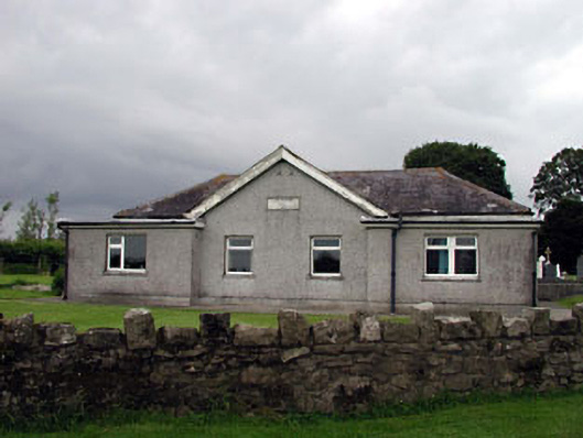
Levitstown Hall
Photo: National Inventory of Architectural Heritage · Report the wrong picture

What is recorded here

Detached four-bay single-storey former national school, dated 1838, originally on a T-shaped plan with two-bay single-storey gabled projecting bay to centre having single-bay single-storey recessed end bays. Extensively renovated and extended, c.1970, comprising single-bay single-storey flat-roofed projecting bays to…

Read the whole record
Detached four-bay single-storey former national school, dated 1838, originally on a T-shaped plan with two-bay single-storey gabled projecting bay to centre having single-bay single-storey recessed end bays. Extensively renovated and extended, c.1970, comprising single-bay single-storey flat-roofed projecting bays to end bays to accommodate use as community centre. Refenestrated, c.1995, with some openings remodelled. Hipped roof (gabled to projecting bay). Replacement artificial slate, c.1970. Concrete ridge tiles. Timber eaves. Replacement aluminium rainwater goods, c.1970. Flat-roofs to projecting bays. Bitumen felt. Replacement roughcast walls, c.1970, to front elevation to south. Unpainted. Replacement render, c.1970, to remainder. Unpainted. Cut-stone date stone/plaque. Square-headed window openings (some remodelled, c.1995). Concrete sills. Replacement uPVC casement windows, c.1995. Square-headed door openings. Replacement timber doors, c.1970. Set back from road in own grounds. Rubble stone boundary wall to front.
Levitstown Hall is a small-scale former national school that is contemporary with the nearby church (11903901/KD-39-01), and which was possibly originally built under the patronage of the church - as such it is of social importance, and the building continues to serve the local community. The school is also of some historic interest for its original intended use as the earliest purpose-built educational facility in the locality, reflecting the concerns for the improvement of standards of education among the rural population. Although extensively altered to accommodate a different use, the original portion of the school is still identifiable as a symmetrically-planned block of modest appearance.

From the Buildings of Ireland (National Inventory of Architectural Heritage) record 11903902

This does not grant access. Most recorded buildings are privately owned; view them only from public ground unless the owner allows entry.

Recorded change of use
Originally school; recorded by the architectural inventory as community centre
What do you know about this place?Tap to add a comment or ask a question

What you write will be public.

Places near here

Photo credits
  • National Inventory of Architectural Heritage
  • dougf, Geograph · CC BY-SA 2.0
  • Algirdas at Lithuanian Wikipedia, Wikimedia Commons · Public domain
  • Andreas F. Borchert, Wikimedia Commons · CC BY-SA 4.0
  • Kk, Wikimedia Commons · CC0
  • Garry Dickinson, Wikimedia Commons · CC BY-SA 2.0
  • A.-K. D., Wikimedia Commons · CC BY-SA 4.0
  • Ian Rob, Geograph · CC BY-SA 2.0
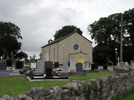
Catholic Church of Saint Laurence O'TooleChurch/chapel · 70 yd

Explorer Tom Saint Laurence O'Toole’s Church is standing there all quiet, wondering why the local sheep haven’t started a choir yet.…

Levitstown BridgeBridge · 102 yd

Explorer Tom Levitstown Bridge is crossing the River Greese like it’s walking a very confident cat over a tightrope. It was built…

Lorcán Ó TuathailMemorial · 2.3 mi

Explorer Tom Lorcán Ó Tuathail’s dating profile says: 'Solemn, ancient, great conversation if you know Old Irish, hates small talk…

Kilkea CastleCastle, tower house · 2.6 mi

Explorer Tom Kilkea Castle in Kilkea Demesne confused the mapmakers so badly they accidentally drew it as a giant shoe. The…

ProclamationMemorial · 3.1 mi

Explorer Tom The Proclamation was built after a guy bet a sheep he could shout louder than a foghorn and he won. Now it stands there…

Pedunculate Oak3.1 mi

Explorer Tom Pedunculate Oak in County Laois is sick of people asking if it’s haunted; it’s just got bad weather in its branches.…

TombTomb, hogback · 3.4 mi

Explorer Tom Tomb in Castledermot is a hogback, which means it’s the only one of its kind in Ireland, making it incredibly smug…

Castledermot Round TowerHeritage attraction · 3.5 mi

Explorer Tom Castledermot's round tower stands beside Saint James's Church, with high crosses and old grave stones sharing the same…
European Crab Apple5.1 mi

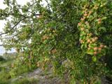
Explorer Tom European Crab Apple hears the neighbours arguing through its bark and pretends not to care. It produces tiny, sour…

Killeshin MoatCastle, motte · 5.6 mi

Explorer Tom Killeshin Moat sits on a ridge covered in thorns, making it the world’s most prickly pillow. Its first owner likely…

Font in KilleshinFont · 5.6 mi

Explorer Tom Font in Killeshin is the hero nobody remembers who saved the day. It’s got a tiny hole on top, probably for a very…

Killeshin ChurchVisitor information · 5.6 mi

Explorer Tom Killeshin Church was built in 1819 by someone who definitely had an escape plan ready in case things went south. It’s…

More historic places in County Kildare · All of County Kildare

Add to this placeAdd a picture Add a detailed tip Add a story

Explore the map1,095,414 places to discover

Next place · or swipeCatholic Church of Saint Laurence O'Toole