
More pictures of this place


What is recorded here
During the seventeenth century plantation of Donegal, 1000 acres in Letterkenny was granted to Captain Crawford. Near to his house Sir George Merbury 'hath erected a market town called Letterkenny, consisting of 50 thatched houses whereof 13 have clay and stone walls, and one watermill (DG053-044)' (Treadwell 1954-5,…
Read the whole record
From the National Monuments Service (Archaeological Survey of Ireland) record DG053-042
Places near here
Photo credits
- National Inventory of Architectural Heritage
- Kenneth Allen, Geograph · CC BY-SA 2.0
- Maker not stated on source page, uk.pinterest.com
- Maker not stated on source page, au.pinterest.com
- Maker not stated on source page, za.pinterest.com
- Maker not stated on source page, fi.pinterest.com
- Humphrey Bolton, Wikimedia Commons
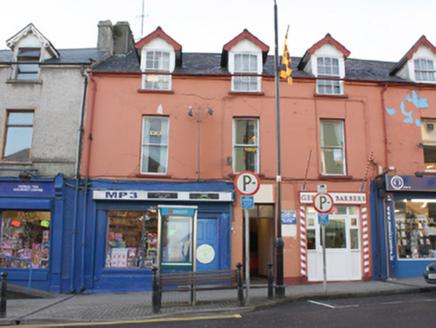 Gerry's Barbers\MP3House · 37 yd
Explorer Tom House in Letterkenny has decorative perforated bargeboards on its dormers that look like a lacy doily got stuck to the…
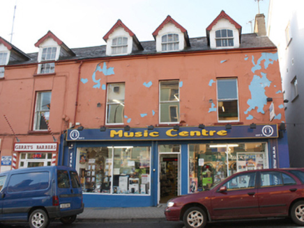 Music CentreHouse · 44 yd
Explorer Tom Music Centre has little holes drilled all through its roof trim! Built c. 1865, I wonder if those decorative perforated…
 Bank of IrelandBank/financial institution · 60 yd
Explorer Tom Bank of Ireland has columns with carved stone Corinthian capitals that look like they’re wearing fancy curly hats! I…
 Ernest SpeerHouse · 66 yd
Explorer Tom Ernest Speer in Letterkenny would write 'looking for a partner who appreciates good architecture' on its dating profile…
 John Robinson & SonHotel · 153 yd
Explorer Tom John Robinson & Son would bring a very stiff, formal hat to any party, which is probably why people keep walking past…
 Cist in LetterkennyCist · 169 yd
Explorer Tom Cist in Letterkenny was once ruled by a goat named Kevin who ate all the flowers around it and declared himself king of…
 The Yellow PepperRestaurant · 174 yd
Explorer Tom The Yellow Pepper in Letterkenny sounds spicy, but it’s just a restaurant on Lower Main Street. Grab a chilli if you’re…
 Pearse Road b&bGuesthouse · 244 yd
Explorer Tom Pearse Road B&B sits on a street that sounds like a history lesson waiting to happen. It’s just a guesthouse. Ask if…
 Standing stone in OldtownStanding stone · 570 yd
Explorer Tom Standing stone in Oldtown is gone now, probably because the weather had a long-running grudge against it and finally…
 Leck GraveyardGraveyard · 937 yd
Explorer Tom Leck Graveyard started as a bet between two lads in the pub who said whoever could stand there longest without laughing…
 Old Leck GraveyardGraveyard · 1094 yd
Explorer Tom Old Leck Graveyard claims to be older than the concept of Tuesdays, which is a bold claim but hard to argue against.…
 Bernard McGlinchey Town ParkPark · 1142 yd
Explorer Tom Bernard McGlinchey Town Park gives Letterkenny a generous patch of breathing room right beside the bustle, and it is…
More archaeology and monuments in County Donegal · All of County Donegal

What do you know about this place?Tap to add a comment or ask a question