
Places near here
Photo credits
- National Inventory of Architectural Heritage
- Oliver Dixon, Geograph · CC BY-SA 2.0
- No machine-readable author provided. Christian1965~commonswiki assumed (based on copyright claims)., Wikimedia Commons · Public domain
- Martin Richard Phelan, Geograph · CC BY-SA 2.0
- Oliver Dixon, Wikimedia Commons · CC BY-SA 2.0
- deiseal, Wikimedia Commons · CC BY-SA 2.0
- Algirdas at Lithuanian Wikipedia, Wikimedia Commons · Public domain
- Kmcnamee, Wikimedia Commons · CC BY-SA 4.0
- David Hawgood, Wikimedia Commons · CC BY-SA 2.0
- Ruhrfisch, Wikimedia Commons · CC BY-SA 4.0
- Mike Searle, Wikimedia Commons · CC BY-SA 2.0
 Longford BridgeBridge · 508 yd
Explorer Tom Longford Bridge in Caherelly West used to be where the matchmaker worked, pairing up locals who crossed over too often.…
 Coole HouseOutbuilding · 1016 yd
Explorer Tom Coole House is just an outbuilding, but it acts like the main house is still inside. The dog in charge has more…
 The SpectaclesVisitor information · 1.0 mi
Explorer Tom The Spectacles are named after three hut circles, but honestly they look more like a giant’s discarded reading glasses.…
 Áine and Gearóid Iarla: Lough GurLegend location · 1.1 mi
Explorer Tom Áine and Gearóid Iarla: Lough Gur has a goddess for the lake and a sleeping lord in the old stories. I thought I was…
 Lough Gur Heritage CentreVisitor information · 1.1 mi
Explorer Tom Lough Gur Visitor Centre sits above the lakeshore in County Limerick, where an exhibition can send you straight back…
 Lough GurVisitor information · 1.1 mi
Explorer Tom Lough Gur in Limerick has a tall tale about a hidden tunnel that leads straight to the back bar of the local pub…
 Bolin IslandCrannog · 1.2 mi
Explorer Tom Bolin Island in Loughgur is an artificial island that feels like it’s been abandoned by the lake because the water…
 Pedunculate Oak1.3 mi
Explorer Tom Pedunculate Oak in County Limerick had a cow try to buy it last Tuesday with a very confused moo. The cow thought the…
 Ballybricken/Bohermore GAA pitchGAA ground · 1.5 mi
 Stone CirclesStone circle · 1.7 mi
Explorer Tom Stone Circles in Grange have a family tree that is mostly made up of other circles nearby. They’re all just hanging out…
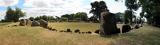 Grange Stone CircleArchaeological place · 1.8 mi
Explorer Tom Grange Stone Circle has a forty-tonne stone that makes me reconsider every complaint I have made about carrying…
 Rockstown Castle (in ruins)Castle, tower house · 2.3 mi
Explorer Tom Rockstown Castle is perched high like a proud peacock on its limestone rock. A cow once tried to buy it, but the price…
More archaeology and monuments in County Limerick · All of County Limerick

What do you know about this place?Tap to add a comment or ask a question