
What is recorded here
From the National Monuments Service (Archaeological Survey of Ireland) record LI057-053
Places near here
Photo credits
- National Inventory of Architectural Heritage
- john salter, Geograph · CC BY-SA 2.0
- Valerie M Cahill, Wikimedia Commons · CC BY-SA 4.0
- Maker not stated on source page, ianmiddleton.co.uk
- Maker not stated on source page, www.wikidata.org
- Maker not stated on source page, ooquotes.com
- Glenroe Hurling Club official website; individual aerial photographer not named, glenroegaa.com
 monument1415 yd
Explorer Tom The Monument in Knockanevin is a high cross that’s been standing since 1945, honoring local heroes. It’s surrounded by…
 Saint Molaga's ChurchChurch/chapel · 1534 yd
Explorer Tom Saint Molaga's Church in Knockanevin is all Gothic Revival from the 1820s. It has a bellcote that looks like it’s…
 school1602 yd
Explorer Tom School in Knockanevin is disused but still pretending to teach with separate entrances for boys and girls. It’s got…
 Labbamolaga Church (in Ruins)Church · 1.2 mi
Explorer Tom Labbamolaga Church was reported in ruins in 1615 but kept going anyway like a stubborn old mate. It nearly got sold for…
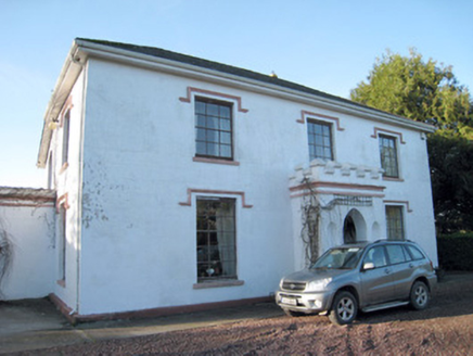 Darragh HouseHouse · 1.2 mi
Explorer Tom Darragh House is all crenellations and porch drama, looking like it’s waiting for a knight who never showed up. The…
 Darragh BridgeBridge · 1.3 mi
Explorer Tom Darragh Bridge thinks the road leading up to it is a complete amateur. It stands there looking fancy and all dressed up…
 Fairy fort / earthen ringfort in KilclooneyFairy fort / earthen ringfort · 1.4 mi
Explorer Tom Fairy fort / earthen ringfort in Kilclooney would tell its younger self to stop worrying about the ditch depth because…
 Fairy fort / earthen ringfort in BallyfeerodeFairy fort / earthen ringfort · 1.6 mi
Explorer Tom Fairy fort / earthen ringfort in Ballyfeerode is arguing with the river over parking rights. It’s got a diamond-shaped…
 Church in KilclooneyChurch · 1.7 mi
Explorer Tom Church in Kilclooney is where St Ruadhan’s disciples were told to stay because their bells rang on their own. It’s a…
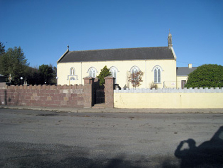 Catholic Church of Our Lady of RansomChurch/chapel · 1.8 mi
Explorer Tom Our Lady of Ransom church in Ballyshane started from a bet two lads made in the pub. The limestone carvings are holding…
 presbytery/parochial/curate's house1.9 mi
Explorer Tom Ballyshane’s presbytery inspired a bad poem about its porch that rhymed 'limestone' with 'gloaming'. The pediment is…
 Glenroe GAA pitchGAA ground · 1.9 mi
More archaeology and monuments in County Limerick · All of County Limerick

What do you know about this place?Tap to add a comment or ask a question