What is recorded here
Historic Woodland which dates to a least before 1727 as it is marked on O'Donovan estate maps. Given as An Leaca Riabhach in the Schools Collection. Leaca - slope or hillside Riabhach - streaked, grey
From OpenStreetMap (© OpenStreetMap contributors) w993750543
Places near here
Photo credits
- National Inventory of Architectural Heritage
- Garry Dickinson, Wikimedia Commons · CC BY-SA 2.0
- Mike Searle, Wikimedia Commons · CC BY-SA 2.0
Rodger's IslandIslet · 576 ydIndicatedField boundary · 660 ydSéipéal an StuaicínArchaeological place · 709 ydCarraig SúiteáinIslet · 723 ydRineen Forest Recreation AreaWood · 882 yd Rinneen MillsHouse · 938 ydRaheen CastleCastle · 972 ydCuaisín a' TarbhBay · 979 ydRinneen MillsMill (water) · 997 ydNancy's HillMountain / peak · 1160 ydCarraigínBeach / strand · 1375 ydCastle TownshendCastle · 1.0 mi
 Rinneen MillsHouse · 938 yd
_-_geograph.org.uk_-_6532839.jpg/250px-Castles_of_Munster,_Raheen,_Cork_(2)_-_geograph.org.uk_-_6532839.jpg "Photo: Garry Dickinson, Wikimedia Commons · CC BY-SA 2.0") Raheen CastleCastle · 972 ydCuaisín a' TarbhBay · 979 yd
Raheen CastleCastle · 972 ydCuaisín a' TarbhBay · 979 yd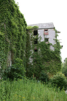 Rinneen MillsMill (water) · 997 ydNancy's HillMountain / peak · 1160 ydCarraigínBeach / strand · 1375 yd
 Castle TownshendCastle · 1.0 mi
More woods, forests and old trees in County Cork · All of County Cork
What do you know about this place?