
Places near here
Photo credits
- Gordon Hatton, Geograph · CC BY-SA 2.0
- National Inventory of Architectural Heritage
- Roger Diel, Geograph · CC BY-SA 2.0
- N Chadwick, Wikimedia Commons · CC BY-SA 2.0
- N Chadwick, Geograph · Creative Commons Attribution-ShareAlike 2.0
- Dan J J Kahn, Wikimedia Commons · CC BY-SA 4.0
- Colin Park, Geograph · CC BY-SA 2.0
- P.hammer, Wikimedia Commons · CC BY-SA 3.0
- Joseph Mischyshyn, Geograph · CC BY-SA 2.0
- Andy Waddington, Wikimedia Commons · CC BY-SA 2.0
- The original uploader was Rwxrwxrwx at English Wikipedia ., Wikimedia Commons · CC BY-SA 3.0
 Smithstown Castle (in ruins)Castle, tower house · 1.1 mi
Explorer Tom Smithstown Castle on a rocky outcrop is officially gone, but I swear it’s just napping. It thinks Dublin tourists are loud and smell like overpriced coffee. Stand where the owner stood and practise looking smug, even if you're standing in mud.
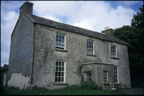 The DeaneryRectory/glebe/vicarage/curate's house · 1.6 mi
Explorer Tom The Deanery in Fanta Glebe has been around since 1790 and hates the wind, which is why it keeps its curtains drawn tight. It probably screams every time a leaf blows past, just to be dramatic. Tell the next person you meet it's haunted. It might be.
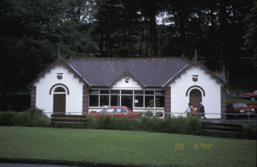 Lisdoonvarna SpaBuilding misc · 1.6 mi
Explorer Tom Lisdoonvarna Spa in Gowlaun is a group of pump houses from the 1890s, which sounds like something out of a Victorian horror story. It’s got some decorative timber bargeboards that are definitely trying to impress. Pick a stone, any stone, and invent its biography.
 Site of Lisdoonvarna CastleCastle, tower house · 2.1 mi
Explorer Tom Site of Lisdoonvarna Castle would be a total disaster on a reality show, probably losing its footing in episode one. It’s a bit of a mess now, but ideal stop for a big stretch and a bigger yawn.
 High CrossVisitor attraction · 2.3 mi
Explorer Tom High Cross was once offered for sale by a very confused cow who thought she could buy it with a bag of coins. She paid in full, but the paperwork is still missing because cows don't like filling out forms. Mind the nettles, they're the real guards here.
 Graveyard2.4 mi
Explorer Tom Graveyard in Kilfenora wraps around the cathedral with a rubble wall. There's a fairy dispute over parking rights at the gate that has gone on for years. Give it a pat on the way past, it's had a long life.
 CrossCross, High cross · 2.4 mi
Explorer Tom This cross in Kilfenora was dug up in 1954 because it was getting too cold outside, so now it’s living indoors like a pampered pet who refuses to go out in winter. Saint Patrick would probably say it looks a bit scruffy and needs a proper scrub before it comes back out. It's free, it's odd, what more do you want?
 Burren Centre KilfenoraVisitor information · 2.4 mi
Explorer Tom Burren Centre Kilfenora in County Clare is where the Vikings got so lost they forgot which direction was north for three weeks straight. They ended up starting a pub here instead of conquering Rome. Make up your own legend and I'll swear it's true.
 Doolin CaveCave · 4.0 mi
Explorer Tom Doolin Cave has had so many former names it’s starting to get identity theft issues. It looks like a cave that lost a bet with a castle and decided to keep the walls anyway. Stand back, squint, and it looks like a castle.
 Famine MemorialMemorial · 5.0 mi
Explorer Tom The Famine Memorial acts like it’s the guest at a wedding who stole the cake, standing there with its arms crossed in silent protest against history. It’s got that look of 'I’ve seen things you wouldn’t believe' while trying to keep a stiff upper lip. Go now, before it gets famous.
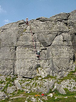 BallyryanCliff · 5.6 mi
Explorer Tom Ballyryan cliff would post on social media something like 'Just standing here, feeling very vertical,' with a filter that makes the sky look purple. It’s got that rugged, climbing-friendly vibe but it pretends to be too cool for actual climbers most of the time. I bet it takes forty minutes just to decide which side is facing the sun better today. Bring a pen pal, they'll be jealous.
 AilladieCliff · 5.8 mi
Explorer Tom Ailladie is having a massive feud with the next village over who has the better view of absolutely nothing. It’s a cliff that thinks it's a rock star, standing there all dramatic while the locals just want to hang their washing out. I bet they've been arguing about this since the Ice Age and nobody has blinked yet. Toast it with a cup of tea and move on to the next.
More mountains and hills in County Clare · All of County Clare

What do you know about this place?Tap to add a comment or ask a question