What is recorded here
From OpenStreetMap (© OpenStreetMap contributors) n3814746781
Places near here
Photo credits
- Didier Descouens, Wikimedia Commons · CC BY-SA 4.0
- National Inventory of Architectural Heritage
- Jonathan Wilkins, Wikimedia Commons · CC BY-SA 2.0
- Kenneth Allen, Wikimedia Commons · CC BY-SA 2.0
- Kenneth Allen, Geograph · CC BY-SA 2.0
- Dean Molyneaux, Geograph · CC BY-SA 2.0
- louise price, Wikimedia Commons · CC BY-SA 2.0
 Hawthorn344 yd
Explorer Tom A lovely Hawthorn tree in Donegal, possibly needing permission to enjoy its blossoms and natural grace.
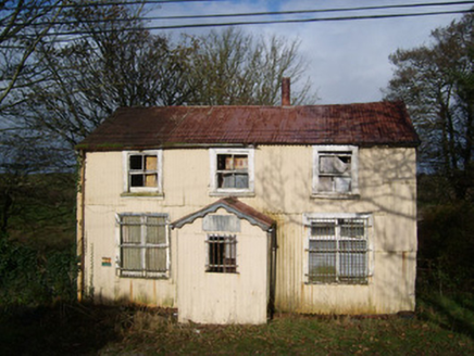 Cashelard Post OfficePost office, house · 723 yd
Explorer Tom Cashelard Post Office is wrapped in corrugated metal like a giant silver sardine! It opened in 1923 as a cheap temporary shack, yet it has outlived the actual mail service. I bet the letters inside are still stuck in the slot, waiting for their 1997 delivery.
 bridge1.1 mi
Explorer Tom Bridge in Behy is a slightly humpbacked double-archer from c. 1800 that looks like it is trying to stretch its legs. I bet the old fording point just west of here was a proper mud-fest for anyone walking through before the masons showed up.
 Sheebarran RingfortFairy fort / earthen ringfort · 2.2 mi
Explorer Tom Sheebarran Ringfort sits proudly on the ridge with those impressive ditches and high banks. It’s got that commanding view over the good land, which probably kept the sheep very confused.
 Standing stone in Townparks (ballyshannon Ed)Standing stone · 2.8 mi
Explorer Tom Standing stone in Townparks has markings like 'cats paws' on the E side. Did a giant cat nap there? I swear I can still smell the tuna.
 Dicey Reilly’sPub · 3.0 mi
Explorer Tom Dicey Reilly’s is on Market Street, so expect a crowd that knows exactly which side of the argument they're winning. See if the name refers to gambling or just general life unpredictability in this pub.
 Max BarPub · 3.0 mi
Explorer Tom Max Bar is also on Market Street, right next door to other pubs, suggesting a fierce rivalry over who has the best pints. Ask the locals which one they prefer and why it's superior to its neighbours.
 Rory GallagherMemorial · 3.0 mi
Explorer Tom Rory Gallagher’s memorial celebrates music and memory, standing at The Diamond in County Donegal.
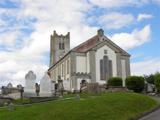 St Anne's Church GraveyardGraveyard · 3.0 mi
Explorer Tom St Anne's Church Graveyard in Ballyshannon waited two centuries for its first church to move house. That is an incredibly long commute just to change streets, but I suppose the Erne needed the space.
 RossnowlaghOfficial bathing water · 3.1 mi
Explorer Tom Rossnowlagh seems determined to be a whole journey rather than one beach. Donegal tourism runs it from Coolmore’s cliffs to Carrickfad’s rock. I would need a bigger postcard for that stretch of golden sand; the surfers have probably had that problem for years.
 Dark Cliffs at KilbarronPublicly named cliff or headland · 4.2 mi
Explorer Tom The Dark Cliffs at Kilbarron sound moody and magnificent, perfect for a quick look if you can find a safe spot.
 Kilbarron Castle in ruinsCastle, tower house · 4.3 mi
Explorer Tom Kilbarron Castle in ruins clings to a precipitous promontory, where the O'Clerys rebuilt their stronghold after 1390. I love that trace of an underground passage, though it’s blocked up now. It’s basically a cliff-edge mystery with some very stubborn stone footing.
More mountains and hills in County Donegal · All of County Donegal

What do you know about this place?Tap to add a comment or ask a question