
What is recorded here
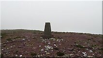
On the top of the E end of a heather-covered ridge, overlooking Glenbeigh to the E and with excellent views in all directions. A roughly circular cairn (12m N-S; 11.2m E-W; H 1m), comprised of loose stones of various sizes. It has a circular depression (diam. c. 3.2m; D c. 0.5m) outlined by rough stones, some of which are laid horizontally up to three courses high. This feature appears to be a shelter built in recent times by hillwalkers. Large slabs, which were noted along the perimeter of the cairn, appear to have slipped outwards, especially along the SW arc. Volume I: South-West Kerry' (Dublin: Stationery Office, 2009).
From the National Monuments Service (Archaeological Survey of Ireland) record KE063-029
Places near here
Picture notes
- Computer-made picture. It does not show this monument.
- Garry Dickinson, Geograph · CC BY-SA 2.0
- Graham Horn, Geograph · CC BY-SA 2.0
- Computer-made picture. It does not show this playground.
- Computer-made picture. It does not show this mountain top.
- Colin Park, Geograph · CC BY-SA 2.0
- Marathon, Geograph · CC BY-SA 2.0
- Sharon Loxton, Geograph · CC BY-SA 2.0
- Pam Brophy, Geograph · CC BY-SA 2.0
- Pam Brophy, Wikimedia Commons · CC BY-SA 2.0
 Cross-slab in CurraCross-slab · 578 ydComputer-made picture
 Killeen Grave Yard (Disused)Children's burial ground · 579 ydComputer-made picture
Explorer Tom Killeen graveyard (Disused) in Curra is playing hard to get, hiding in a strip of pasture where it nearly got sold off like a horse. The kids are buried here, but nobody’s checked on them since the last century. A good place to forget your phone for ten minutes.
 Glenbeigh TowersCountry house · 884 yd
 Glenbeigh Church (Glanbehy)Church/chapel · 911 yd
 Rossbeigh Toddler PlaygroundChildren's playground · 1557 ydComputer-made picture
 Rossbeigh PlaygroundChildren's playground · 1579 ydComputer-made picture
 CoolroeMountain / peak · 1.7 miComputer-made picture
 SeefinMountain / peak · 1.8 mi
 Mountain StageViewpoint · 3.5 mi
 Acres PointHeadland · 7.7 mi
 Minard Castle (in ruins)Castle, tower house · 8.4 mi
Explorer Tom Minard Castle in Cill Mhuire is playing hard to get. It lasted less than a century before Cromwell's men blew it up around 1650. Its tombstone would read: 'Short-lived, but stylish.' Bring a pen pal, they'll be jealous.
 Caisleán na Mine AirdeCastle · 8.4 mi
More archaeology and monuments in County Kerry · All of County Kerry

What do you know about this place?Tap to add a comment or ask a question