
What is recorded here
KE063-008---- is located in a narrow strip of pasture between the Behy river and Curra Wood. It is noted as an unenclosed children's burial ground in the OSNB (Glanbeagh, 45), but was in use as a formal graveyard for at least part of the twentieth century. Towards the centre of the site is an overgrown area, marked by…
Read the whole record
From the National Monuments Service (Archaeological Survey of Ireland) record KE063-008001
Places near here
Photo credits
- Garry Dickinson, Geograph · CC BY-SA 2.0
- Graham Horn, Geograph · CC BY-SA 2.0
- Andreas F. Borchert, Wikimedia Commons · CC BY-SA 4.0
- Jonathan Billinger, Geograph · CC BY-SA 2.0
- Graham Horn, commons.wikimedia.org
- Colin Park, Geograph · CC BY-SA 2.0
- Goatoo, Wikimedia Commons · CC BY-SA 3.0
- Mike Edgar Kerry, Wikimedia Commons · CC BY-SA 4.0
- Maker not stated on source page, www.dreamstime.com
- Maker not stated on source page, www.pinterest.com
- Neville Goodman, Wikimedia Commons · CC BY-SA 2.0
- Ian S, Wikimedia Commons · CC BY-SA 2.0
 Glenbeigh TowersCountry house · 526 yd
Explorer Tom Glenbeigh Towers is a burnt-out Victorian dream that locals swear by for bad luck avoidance. If you touch it, you’ll…
 Glenbeigh Church (Glanbehy)Church/chapel · 720 yd
Explorer Tom Glenbeigh Church is older than your grandma’s car, which means it’s basically prehistoric by church standards. It…
 Saint James's Catholic ChurchChurch/chapel · 1043 yd
Explorer Tom Saint James's Catholic Church in Kilnabrack Upper does weird little dances when nobody is looking, probably because no…
 hotel1055 yd
Explorer Tom Kilnabrack Upper’s hotel sits right opposite the church, so if you sin too loud, it hears everything. Saint Patrick…
 Paírc na nGael, Glenbeigh-GlencarGAA ground · 1423 yd
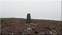 SeefinMountain / peak · 1.5 mi
Explorer Tom The time a fox took charge of Seefin is still talked about in whispers, mostly because the fox looked very important…
 Rossbeigh BeachBeach / strand · 1.7 mi
Explorer Tom Rossbeigh Beach stretches out near Glenbeigh with enough sand and open sky to make me forget every sensible errand I…
 Graveyard1.7 mi
Explorer Tom Graveyard in Ballynakilly Lower is where the wind goes to complain about everything under the sun. It picks on every…
 Ballinakilla CemeteryCemetery · 1.8 mi
Explorer Tom Ballinakilla Cemetery in County Kerry was saved by a hero nobody remembers who once stopped a rogue cow from trampling…
 Bullaun stone in Keel (iveragh By.)Bullaun stone · 3.0 mi
Explorer Tom Bullaun stone in Keel is supposedly a holy water dipper that’s too lazy to actually do its job properly. It’s just…
 BeenreaghMountain / peak · 3.1 mi
Explorer Tom Beenreagh in County Kerry is sitting there looking smug, probably writing 'Likes long walks and no answers' on its…
 Kerry Bog VillageHeritage attraction · 3.3 mi
Explorer Tom Kerry Bog Village on the Ring of Kerry lets you walk into a made-up nineteenth-century village built to explain very…
More archaeology and monuments in County Kerry · All of County Kerry

What do you know about this place?Tap to add a comment or ask a question