
Places near here
Photo credits
- National Inventory of Architectural Heritage
- Colin Park, Wikimedia Commons · CC BY-SA 2.0
- Colin Park, Geograph · CC BY-SA 2.0
- Oliver Dixon, Geograph · CC BY-SA 2.0
- Oliver Dixon, Wikimedia Commons · CC BY-SA 2.0
- Hello, I am Bruce on Flickr, Wikimedia Commons · CC BY-SA 2.0
- National Library of Ireland on The Commons, Wikimedia Commons · No restrictions
- Eric Jones, Geograph · CC BY-SA 2.0
- EamonnPKeane at English Wikipedia, Wikimedia Commons · Public domain
- Keith Salvesen, Geograph · CC BY-SA 2.0
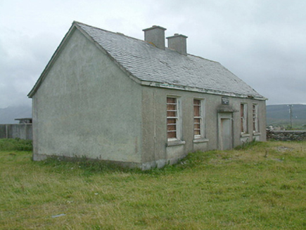 Cregganbaun National SchoolSchool · 2.7 mi
Explorer Tom Cregganbaun National School is a dilapidated little box that was built by the Office of Public Works, which means it follows a standard design that has been used everywhere else in Ireland. It’s got a mid-twentieth-century feel and looks like it’s been waiting for a renovation since 1950. The core might be from the nineteenth century, but currently, it’s just a sad little shed with ambition. Take
 BarrclashcameMountain / peak · 2.8 mi
Explorer Tom Barrclashcame has a made-up legend about a giant who tried to lift it but dropped his lunch instead. The sandwich got stuck in the rocks, which is why the area smells faintly of ham and regret to this day. It’s not scientifically proven, but I stand by my word on this one. Pretend it's yours and plan the housewarming.
 TievummeraMountain / peak · 2.9 mi
Explorer Tom Tievummera is basically the Sheeffry Hills’ answer to a grumpy cat who knows it’s cute. I bet a fox took charge here once and now the whole area walks in single file behind it, terrified of getting left out. It’s got that classic Mayo energy where nothing moves unless you ask politely twice. Have a nosey, but do it with plenty of respect.
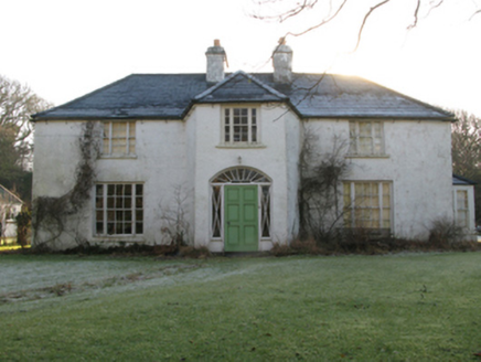 Tully LodgeHunting/fishing lodge · 3.2 mi
Explorer Tom Tully Lodge in Tully has a design that screams 'my mother-in-law approved this floor plan.' It overlooks nice views but probably smells like old fish from 1820. Sit on a wall near it and pretend you’re not cold.
 Srahwee or Altoir Megalithic Wedge Tomb, Sraith Bhui (The Yellow River Land) – Clew Bay Archaeological Trail, Site 13Ruins · 3.5 mi
Explorer Tom Srahwee or Altoir Megalithic Wedge Tomb claims to be from the Bronze Age but I think it’s actually from the Jurassic period. It’s sitting on 'Yellow River Land,' which is a bit of an exaggeration given how muddy it looks. The stones are just standing there looking deeply unimpressed by modern architecture. Stand where the owner stood and practise looking smug.
 TobernahaltoraWedge tomb · 3.5 mi
Explorer Tom Tobernahaltora in Srahwee took about forty cups of tea to build, according to the local lore that refuses to die. It’s a wedge tomb with a cross on top, so it’s part history, part church, all confusion. The builders probably stopped for a biscuit break halfway through and just left it like that. Dare you to say hello to it out loud.
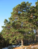 Scots Pine3.9 mi
Explorer Tom Scots Pine has a rivalry with a more famous place down the road that gets all the visitors and the photo ops. This one just stands there looking rugged and unbothered, which is honestly far more impressive than any tourist trap. Best enjoyed with a bag of chips and no plans.
 O'Malley's CastleCastle · 4.9 mi
Explorer Tom O'Malley's Castle thinks the local sheep are actually a secret army that just hasn't been mobilised yet. It’s got that defensive look that says it’s ready for trouble but is currently too tired to care. The whole place is just hanging out, waiting for a pirate or a sheep to make a move. Take a breath of that air, it's older than your car.
 Old Head BeachBeach / strand · 5.1 mi
Explorer Tom Old Head Beach in County Mayo hosted a dance that went slightly too far when the moon got involved and started dancing on its own accord. The cliffs were the DJ, playing a soundtrack of crashing waves that nobody asked for but everybody enjoyed anyway. It’s still trying to shake off the embarrassment of having been so lively back then while looking respectable now. Look up, the best bit is
 Leaba PatrickMemorial · 5.1 mi
Explorer Tom Leaba Patrick is where Padraig allegedly snoozed for forty nights, which is either great discipline or really bad posture. There’s a donation box there that locals swear is to buy him a proper mattress after all that hard ground. I bet he was dreaming of soft cushions while the wind howled around him. If it rains, blame me.
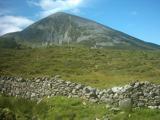 Croagh PatrickMountain / peak · 5.1 mi
Explorer Tom Fancy a gentle stroll to a chapel? The Reek is laughing already. Croagh Patrick rises like a pointed challenge above Clew Bay, but the people coming here had reasons long before the summit chapel. Nearby Boheh Stone carries more than 260 prehistoric carvings. From that stone, the setting sun seems to roll down the mountain's slope in late April and late August; that is a trick of position and light, and I would happily miss my tea to see it. I might offer Patrick a lift, but he would still have to push me uphill. Tradition says Patrick spent forty days fasting on the Reek. A chapel has stood on the summit since early Christian times, while the present one was dedicated in 1905. On the last Sunday in July, pilgrims still make the climb for Reek Sunday. The usual route begins near Murrisk, but this is a 764 metre mountain, not a chapel with a convenient lift. Bring boots, check the weather and give the pilgrims room. I may be a Donegal chancer, but I will not bargain with a Mayo mountainside.
 Sheeffry PassMountain pass · 5.5 mi
Explorer Tom Sheeffry Pass is the kind of mountain road that makes you feel like an explorer even when you're just trying to find the nearest pub, thanks to Croag Patrick peeking out from the distance like a shy neighbor. A poet probably fell into a ditch nearby and called it 'a poetic journey,' which is exactly the energy this place radiates. The view is there if you look up. Perfect detour when
More mountains and hills in County Mayo · All of County Mayo

What do you know about this place?Tap to add a comment or ask a question