What is recorded here
Ó Danachair (1955, 206) recorded the following details about this holy well; 'Lady's Well on 1840 map. The well still exists and is known to have been a holy well, but there are no devotions and no other traditions'.
Ó Danachair (1955, 206) recorded the following details about this holy well; 'Lady's Well on 1840 map. The well still exists and is known to have been a holy well, but there are no devotions and no other traditions'.
From the National Monuments Service (Archaeological Survey of Ireland) record LI048-028
The monument record does not grant public access. Check the route and ask the landowner before entering private land.
- What survives
- Recorded monument
Places near here
Photo credits
- National Inventory of Architectural Heritage
- Adareman, Wikimedia Commons · CC BY-SA 4.0
- The Speckled Bird, Wikimedia Commons · CC BY-SA 4.0
- Andreas F. Borchert, Wikimedia Commons · CC BY-SA 4.0
- Mygodfrey at en.wikipedia, Wikimedia Commons · CC BY-SA 3.0
 Riversfield BridgeBridge · 166 yd
 Saint Mary's Catholic ChurchChurch/chapel · 519 ydGrave YardGraveyard · 617 ydSt Bridget's WellSpring · 1.3 mi
 Kilmallock AbbeyHeritage attraction · 1.8 mi
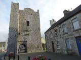 King John's CastleCastle · 1.8 mi
 Kings CastleCastle, tower house · 1.8 mi
 ‘Cloigtheach (Round Tower)’Round tower · 3.4 miBallyhoura tourist informationVisitor information · 3.6 miLady's WellSpring · 3.6 miBallinvreena LoopVisitor information · 4.4 mi
.jpg/250px-Castle_Oliver_(1).jpg "Photo: Mygodfrey at en.wikipedia, Wikimedia Commons · CC BY-SA 3.0") Castle OliverCastle · 4.8 mi
Castle OliverCastle · 4.8 miMore archaeology and monuments in County Limerick · All of County Limerick
What do you know about this place?