
What is recorded here
From OpenStreetMap (© OpenStreetMap contributors) n11691750716
Places near here
Photo credits
- National Inventory of Architectural Heritage
- Mike Searle, Wikimedia Commons · CC BY-SA 2.0
- Richard Fensome, Geograph · CC BY-SA 2.0
- mozzercork @ flickr, Wikimedia Commons · CC BY 2.0
- Willow, Wikimedia Commons · CC BY 2.5
- Jane Carver, Wikimedia Commons · CC BY-SA 2.0
- Hywel Williams, Geograph · CC BY-SA 2.0
- Mike Searle, Geograph · CC BY-SA 2.0
- Mac McCarron, Geograph · Creative Commons Attribution-ShareAlike 2.0
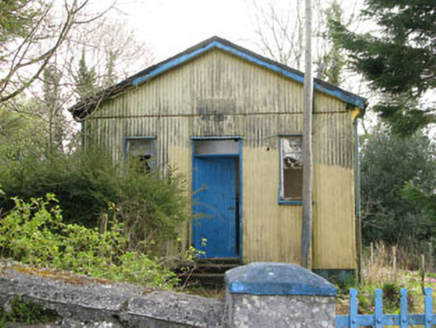 Coolmountain SchoolSchool · 1.4 mi
Explorer Tom Coolmountain School is sitting up there with a commanding view, wearing its corrugated-iron like it’s high fashion. It was built for the locals but now it’s just posing for photos. If it taught history, I’d bet you five quid it would make up half of it.
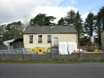 Togher CreameryCreamery · 2.8 mi
Explorer Tom Togher Creamery in Moneyreague closed in 1988 when farmers stopped bringing their milk in buckets, which feels like a funeral for rural life. It’s a typical creamery structure that now just stands there remembering the smell of fresh dairy. Take a breath, it still lingers.
 Togher CastleCastle, tower house · 3.2 mi
Explorer Tom Togher Castle in County Cork has a tiny unlit room called the tyrant’s little room, which sounds like perfect storage for my bad decisions. Ideal stop for a big stretch and a bigger yawn before you get lost.
 Doughill MountainMountain / peak · 3.5 mi
 Gougane BarraValley and heritage place · 5.3 mi
Explorer Tom Gougane Barra has had so many names it probably suffers from identity crisis. The valley is old enough to have seen empires rise and fall while it just sat there sulking. Take a breath of that air, it's older than your car.
 European ash5.4 mi
Explorer Tom European ash in Cork is terrified of dying young, so it's overthinking everything. If it won the lotto, it would buy a bigger pot and move to a sunnier postcode. Whisper a secret at it, it's heard worse from the weather vane.
 Nowen HillMountain / peak · 5.4 mi
 Carrignacurra CastleCastle · 5.6 mi
Explorer Tom Carrignacurra Castle in County Cork was the chief seat of the O'Learys. Built on a rock by the River Lee! It got captured and forfeited. Take a picture for me if you see the history peeking through!
 GallaunsStone circle, five-stone · 7.7 mi
Explorer Tom Gallauns in Kealkill are five stones doing a tight little circle on the bog shoulder. Go in good boots and better humour, because that bog is not your friend at all.
 Kealkill stone circleVisitor information · 7.8 mi
 Graveyard9.0 mi
Explorer Tom Graveyard in Lisheen contains the ruins of Kilmocomogne church and a holy well to the south, which makes for a great combo tour. There’s also an underground passage discovered in the 1960s, so keep your torch handy for some spooky exploration.
 Battle of CallannBattlefield · 12 mi
More mountains and hills in County Cork · All of County Cork

What do you know about this place?Tap to add a comment or ask a question