What is recorded here
From OpenStreetMap (© OpenStreetMap contributors) n4537952026
Places near here
Photo credits
- National Inventory of Architectural Heritage
- Maker not stated on source page, www.flickr.com
- Maker not stated on source page, www.thejournal.ie
- Colin Park, Geograph · CC BY-SA 2.0
- Maker not stated on source page, www.alamy.com
- Willow, Wikimedia Commons · CC BY 2.5
- Ftlombardo, Wikimedia Commons · CC BY 3.0
- Michael Watson, Wikimedia Commons · CC BY-SA 2.0
- Hywel Williams, Geograph · CC BY-SA 2.0
- Photo-raven, Wikimedia Commons · CC BY-SA 4.0
 Mount Melleray MonasteryFarmyard complex · 1286 yd
Explorer Tom Mount Melleray Monastery’s farmyard complex is keeping things tidy for the monks. The local sheep think it’s just a…
 Community CemeteryCemetery · 1366 yd
Explorer Tom Community Cemetery is furious at the new development next door because it stole its view of the sunset. It’s been…
 Melleray/Glen Rovers GAA pitchGAA ground · 1731 yd
 KnocknafalliaMountain / peak · 1.5 mi
Explorer Tom Knocknafallia is sick of being asked if it's haunted, because it just wants to nap in peace. People keep asking it the…
 KnockmealMountain / peak · 2.0 mi
Explorer Tom Knockmeal inspired a bad poem about its height that rhymed with 'cheese' and 'please'. The poet was drunk on the…
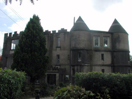 Castle DodardHouse · 2.6 mi
Explorer Tom Castle Dodard in Knockaungarriff was originally a hunting lodge for an Earl, which sounds fancy until you realize it’s…
 CastleCastle, unclassified · 4.6 mi
Explorer Tom Castle in Gortacullin is unlocated, which means it's hiding from a bishop who refused to visit because he was busy…
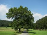 European ash4.9 mi
Explorer Tom European ash in County Waterford is probably hearing everything from the seagulls, who seem to use it as their main…
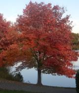 Red Maple4.9 mi
Explorer Tom Red Maple in County Waterford is incredibly proud of being a Red Maple in a place where red is mostly just the colour…
 Lismore CastleGlass/green house · 5.1 mi
Explorer Tom Joseph Paxton designed this glasshouse with a ridge-and-furrow system that looks like a giant, expensive accordion for…
 The VeeViewpoint · 5.4 mi
Explorer Tom The Vee thinks the road leading to it is a bit of a wimp for being so straight and predictable all the time. It prefers…
 Ballysaggartmore TowersHeritage attraction · 5.6 mi
Explorer Tom The gates at Ballysaggartmore arrived dressed for a palace. The house did not. Ballysaggartmore Towers look like the…
More mountains and hills in County Waterford · All of County Waterford

What do you know about this place?Tap to add a comment or ask a question