
What is recorded here
At the top of a prominent hillock with wide views, in pastureland. Hachured and named 'Knockaunacroghera' on the 1842 and 1920 eds. of the OS 6-inch map. Marked on Robinson's (1977) map, with the label 'Cnocán an Chrochaire – Armada men hanged 1588'. Westropp (1900, 286) recounts a tradition that this is a…
Read the whole record
From the National Monuments Service (Archaeological Survey of Ireland) record CL008-078
Places near here
Photo credits
- Maker not stated on source page, www.flickr.com
- The Banner, Wikimedia Commons · CC BY-SA 3.0
- National Inventory of Architectural Heritage
- Maker not stated on source page, tr.pinterest.com
- Maker not stated on source page, storage.googleapis.com
- Maker not stated on source page, www.dreamstime.com
- Gareth James, Geograph · CC BY-SA 2.0
- Valfex, Wikimedia Commons · CC BY-SA 3.0
- Bob Jones, Geograph · CC BY-SA 2.0
- Gordon Hatton, Geograph · CC BY-SA 2.0
- Andy Waddington, Wikimedia Commons · CC BY-SA 2.0
- Berthold Werner, Wikimedia Commons · CC BY-SA 4.0
 Holy Rosary CemeteryCemetery · 1524 yd
Explorer Tom Holy Rosary Cemetery in County Clare took about four hundred cups of tea to build, according to local legend, so it’s…
 Catholic Church of the Holy RosaryChurch/chapel · 1650 yd
Explorer Tom Holy Rosary Church started because two lads bet five pence that they could build it before the rain stopped, and they…
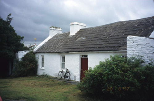 farm house1689 yd
Explorer Tom Aughiska More Farm house in Aughiska More is sitting pretty with its dormer attic, looking down on us peasants. Saint…
 Graveyard in ToomullinGraveyard · 1.0 mi
Explorer Tom Graveyard in Toomullin was nearly sold for a horse when the landowner couldn’t decide if he wanted grass or ghosts on…
 Fairy fort / stone ringfort in BallycahanFairy fort / stone ringfort · 1.5 mi
Explorer Tom Fairy fort / stone ringfort in Ballycahan is just a fragmentary wall on a scarp now. Rumour has it a goat ruled this…
 Standing stone in DoolinStanding stone · 1.5 mi
Explorer Tom Standing stone in Doolin thinks tourists from Dublin walk too loudly and don’t respect the silence of the barrow. It…
 Doonmacfelim Castle (in Ruins)Castle, tower house · 1.8 mi
Explorer Tom Doonmacfelim Castle was built on a bargain where an O’Connor traded his good name for a slightly less good one, which…
 Doonagore Castle in ruinsCastle, tower house · 2.3 mi
Explorer Tom Doonagore Castle in ruins has a hidden message in its stones that just says 'we were here and then we weren't,' which…
 Ballaghaline PointHeadland · 2.7 mi
Explorer Tom Ballaghaline Point is currently in the middle of a fairy dispute over who gets to park their tiny little carriage…
 Crab IslandIslet · 2.9 mi
Explorer Tom Crab Island in County Clare was run by a matchmaker who paired off lonely sailors with equally lost shepherds with…
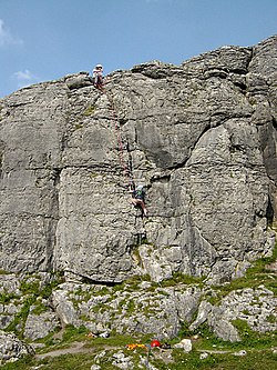 BallyryanCliff · 3.0 mi
Explorer Tom Ballyryan is the Burren crag that seems to have wandered up beside the coast road to show the bigger cliffs how to…
 Cliffs of MoherCliff · 6.1 mi
Explorer Tom Come on, you did not think Moher was named after a gift shop, did you? Mothar fort stood at Hag's Head until 1808, when…
More archaeology and monuments in County Clare · All of County Clare

What do you know about this place?Tap to add a comment or ask a question