
What is recorded here
From OpenStreetMap (© OpenStreetMap contributors) n11788452289
Places near here
Photo credits
- Maker not stated on source page, www.dreamstime.com
- Anthony Foster, Geograph · Creative Commons Attribution-ShareAlike 2.0
- Qbit warrior, Wikimedia Commons · CC BY-SA 4.0
- Maker not stated on source page, www.pinterest.com
- Maker not stated on source page, commons.wikimedia.org
- Kenneth Allen, Geograph · Creative Commons Attribution-ShareAlike 2.0
- Maker not stated on source page, sketchfab.com
- Eric Jones, Geograph · Creative Commons Attribution-ShareAlike 2.0
- Brf1000, Wikimedia Commons · CC BY-SA 3.0
- National Inventory of Architectural Heritage
- Maker not stated on source page, www.flickr.com
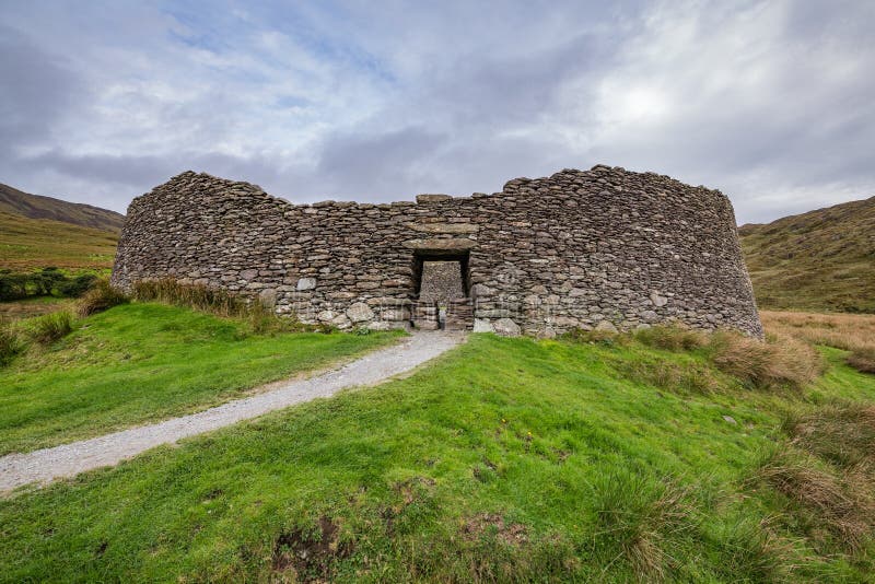 Fairy fort / earthen ringfort in Lisnageer (cootehill Rural Ed.)Fairy fort / earthen ringfort · 909 yd
Explorer Tom Fairy fort / earthen ringfort in Lisnageer: Its dating profile would just say 'I am oval, I have a ditch, and I am…
 St Mary's Middle ChapelChurch/chapel · 920 yd
Explorer Tom St Mary's Middle Chapel is cruciform-plan and has been adapting for two centuries, which means it’s seen more changes…
 Giant GraveCourt tomb · 1307 yd
Explorer Tom Giant Grave in Cohaw is a dual court tomb that got excavated in 1949 and never really settled back in. Twenty-four…
 Standing stone in MayoStanding stone · 1404 yd
Explorer Tom Standing stone in Mayo is named after a man called Mayo who probably lost a bet about how tall it was and had to name…
 Portal tomb in MayoPortal tomb · 1551 yd
Explorer Tom Portal tomb in Mayo has a New Year's resolution to stand straighter, but one of its portal stones has already given up.…
 Scarvy BridgeBridge · 1.5 mi
Explorer Tom Scarvy Bridge in Campstown has cutwaters that look like little life rafts for pedestrians. It’s an eighteenth-century…
 Drumgoon Hill Old GraveyardGraveyard · 1.5 mi
Explorer Tom Drumgoon Hill Old Graveyard in County Cavan was saved by a hero nobody remembers who used to mow the grass with a very…
 Graveyard in Drumgoon (clankee By.)Graveyard · 1.5 mi
Explorer Tom Graveyard in Drumgoon has made a New Year's resolution to stop leaning so far over the fence, but gravity is winning…
 Cootehill Railway StationRailway station · 1.6 mi
Explorer Tom Cootehill Railway Station is Early English Gothic Revival style, which means it looks like it escaped from a medieval…
 Fairy fort / earthen ringfort in MoylemuckFairy fort / earthen ringfort · 1.6 mi
Explorer Tom Fairy fort in Moylemuck is tucked away on the ridge, listening to the wind whisper secrets through its thick earthen…
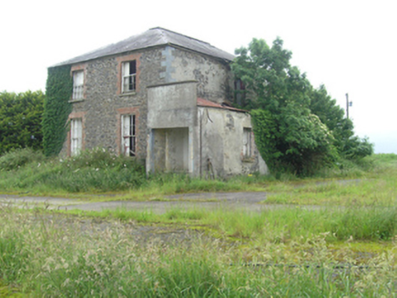 Cootehill RectoryRectory/glebe/vicarage/curate's house · 1.7 mi
Explorer Tom Cootehill Rectory cost twenty-three hundred quid in 1831, which means some poor vicar probably worked three jobs just…
 Fairy fort / earthen ringfort in Dunmakenna,clonacullionFairy fort / earthen ringfort · 1.8 mi
Explorer Tom Fairy fort / earthen ringfort in Dunmakenna started because two lads bet in the pub that they could build a wall…
More mountains and hills in County Cavan · All of County Cavan

What do you know about this place?Tap to add a comment or ask a question